You're viewing old version number 11. - Current version
Toledo total snowfall winter record 2013-2014
( As of Feb 24, 2014: No record yet. Here's my comment in a toledotalk.com thread. )
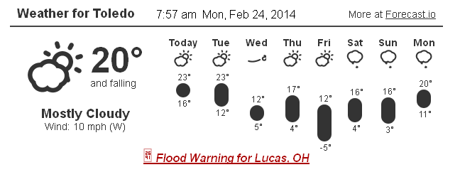
Chilly weather is forecast for Toledo this week.
Toledo Express Airport has not recorded any snowfall, since the 4 to 5 inches of snow that we received about a week ago.
The airport still needs 0.4 inches of snow to tie its all-time Toledo winter record for snowfall, since record-keeping began. Our snowfall record is 73.1 inches, set during the 1977-78 winter.
For record-keeping, the National Weather Service tracks total snowfall since July 1. As of yesterday, Feb 23, 2014, our current total is 72.7 inches.
Toledo's average total snowfall by the Feb 23 date is 29.1 inches. Toledo averages 37.6 inches of snowfall between July 1 and July 1.
The meteorological winter is defined by December 1 through February 28/29. I thought that the "winter" snow record was defined by these parameters, but it's not. Good thing, because it's forecast to be mostly dry through Fri, Feb 28.
If we're going to have this much snow, may as well set a record. If we don't get much snow during the final week of February, no big deal. We still have March, April, May, and June to receive a half inch of snow.
Toledo Express Airport recorded 17.4 inches of snow in March 2008, so we have a chance to shatter the record.
Last fall, Toledo Express Airport recorded no snow in October and only a half inch in November, giving us 72.2 inches of total snowfall for the three-month period of Dec, Jan, and Feb. For the 1977-1978 record, I don't know how much snow fell in the fall and spring. Our current winter has nearly broken the record in only a three-month period.
The best chance for snow this week is tonight and tomorrow.
Tonight: A chance of snow showers, mainly after 1am. Cloudy, with a low around 10. Wind chill values as low as -1. West wind 7 to 16 mph. Chance of precipitation is 30%. New snow accumulation of less than a half inch possible.
Tuesday: A chance of snow showers, mainly before 11am. Mostly cloudy, with a high near 23. Wind chill values as low as -2. West wind 10 to 15 mph. Chance of precipitation is 30%. New snow accumulation of less than a half inch possible.
When the record finally breaks, celebrate accordingly by drinking a favorite beverage or pushing someone down, depending upon your mood at this point.
quote=172530
I thought that the record was based upon the meteorological winter calendar of December 1 through February 28/29, but that's incorrect.
We have until June 30, 2014 to receive 0.5 inches of snow to break the record.
The 2014-2015 winter snowfall recording period begins on July 1.
On average, Toledo has recorded 29 inches of snow by February 24 and 37 inches of total snowfall for the year. So if we're only average from now through the spring, we should get another 8 inches of snow.
A warm thought is that the meteorological "spring" begins this Saturday, March 1, although the forecast high temp for Toledo is 15 degrees, so I guess not so warm.
"March 21st, first day of Spring."
As far as I know, the NWS does not use the solstice and equinox dates for stat keeping. They begin their stat dates on the first day of the month. For meteorologists, winter ends on February 28/29, but the snowfall recording period for 2013-2014 ends on June 30.
By JR
- 588 words
created:
- updated:
source
- versions
Related articles
Nov 17, 2013 Toledo area weather notes - Mar 03, 2014
Posts related to Nov 17, 2013 severe weather - Nov 21, 2013
Driving in a real Toledo winter - Jan 13, 2014
Snowstorm info - Dec 31, 2013 - Jan 2, 2014 - Mar 03, 2014
Enjoying Toledo Winter 2013-2014 - Feb 17, 2014
more >>