Toledo Weather - Wed, Mar 12, 2014
hazardous weather outlook
national weather service cleveland oh
422 pm edt tue mar 11 2014
ohz003-006>009-017>019-122030-
lucas-wood-ottawa-sandusky-erie oh-hancock-seneca-huron-
422 pm edt tue mar 11 2014
...winter storm warning in effect from 2 am to 8 pm edt wednesday...
this hazardous weather outlook is for north central ohio and
northwest ohio.
.day one...tonight.
please listen to noaa weather radio or go to weather.gov on the
internet for more information about the following hazards.
winter storm warning.
ice jam flooding may be possible through tonight as any remaining
snow melts and flows into area creeks and rivers. rainfall
developing tonight will increase the threat.
.days two through seven...wednesday through monday.
please listen to noaa weather radio or go to weather.gov on the
internet for more information about the following hazards.
winter storm warning.
.spotter information statement...
spotter activation is not expected at this time.
urgent - winter weather message
national weather service cleveland oh
429 am edt wed mar 12 2014
.low pressure will move through the lower ohio valley today. rain
will move into the area ahead of the low this morning. the rain
will change to snow towards sunrise in northwest ohio and spread
southeast this morning as colder air moves in behind the low. a
period of sleet or freezing rain is also possible before changing
to all snow. based on the current track of the storm...snowfall
should be highest across northern ohio into northwest
pennsylvania. a glaze of ice will also be possible most areas.
ohz003-006>009-017>019-121630-
/o.con.kcle.ws.w.0004.000000t0000z-140313t0000z/
lucas-wood-ottawa-sandusky-erie oh-hancock-seneca-huron-
including the cities of...toledo...bowling green...port clinton...
fremont...sandusky...findlay...tiffin...norwalk
429 am edt wed mar 12 2014
...winter storm warning remains in effect until 8 pm edt this
evening...
- accumulations...snow accumulation of 4 to 8 inches. a light
glaze of ice is also possible.
- timing...rain will become widespread early this morning and
transition to snow towards sunrise. a mix of sleet and freeing
rain is possible as the precipitation transitions. the heaviest
snow should occur from wednesday morning into the early
afternoon and then taper off by late afternoon.
- winds...north 20 to 30 mph with gusts up to 45 mph.
- impacts...precipitation will transition to snow during the
morning commute and make travel hazardous and slow. untreated
surface will be slick. in addition strong winds will cause
blowing snow and poor visibilities.
- visibilities...will drop below a quarter mile in the heaviest
snow. white out conditions may briefly occur.
- temperatures...will fall through the day to near 20 degrees by
late afternoon and into the single digits overnight.
precautionary/preparedness actions...
a winter storm warning is issued when severe winter weather is
expected. heavy snow and/or ice will cause hazardous driving
conditions. if you will be traveling in the warning area you
should choose an alternate route if possible... or you should use
extreme caution if travel is unavoidable. stay tuned to noaa
weather radio for further details or updates.
TOL
Mar 12, 2014 4:52 am
Weather : Overcast and Breezy
Temperature : 33 F
Humidity : 82%
Wind Speed : NE 24 mph
Barometer : 29.54 in
Dewpoint: 28 F
Visibility : 10.00 statute miles
Toledo 7-day forecast
Last Update: Mar 12, 2014 4:05 am
Today: Rain and snow, possibly mixed with sleet, becoming all snow after 4pm. The snow could be heavy at times. Temperature falling to around 20 by 5pm. Breezy, with a north wind 18 to 23 mph, with gusts as high as 38 mph. Chance of precipitation is 100%. Total daytime snow and sleet accumulation of 3 to 7 inches possible.
Tonight: A chance of snow before 7pm, then a slight chance of snow showers between 7pm and 8pm. Cloudy, then gradually becoming partly cloudy, with a low around 1. Wind chill values as low as -10. North wind 12 to 17 mph decreasing to 6 to 11 mph after midnight. Winds could gust as high as 30 mph. Chance of precipitation is 30%. New snow accumulation of less than a half inch possible.
Thursday: Mostly sunny, with a high near 20. Wind chill values as low as -12. West wind 7 to 10 mph.
Thursday Night: Mostly cloudy, with a low around 18. Southwest wind 11 to 13 mph.
Friday: Partly sunny, with a high near 43. Southwest wind 11 to 17 mph.
Friday Night: A chance of rain and snow showers before midnight, then a chance of snow showers. Mostly cloudy, with a low around 30. Chance of precipitation is 40%. New precipitation amounts of less than a tenth of an inch possible.
Saturday: A chance of snow showers before noon. Partly sunny, with a high near 39. Chance of precipitation is 30%.
Saturday Night: Mostly cloudy, with a low around 18.
Sunday: Partly sunny, with a high near 28.
Sunday Night: Mostly cloudy, with a low around 12.
Monday: Mostly sunny, with a high near 31.
Monday Night: Partly cloudy, with a low around 17.
Tuesday: Partly sunny, with a high near 46.
fxus61 kcle 120900
afdcle
area forecast discussion
national weather service cleveland oh
500 am edt wed mar 12 2014
synopsis...
a snow storm will impact the area today as low pressure tracks
northeast from the ohio valley to near new jersey by this evening.
high pressure over the northern plains will build across the central
great lakes on thursday...shifting to the southeastern states by
friday. a warm front will lift north across the area on friday ahead
of low pressure passing north of the great lakes.
&&
near term /through tonight/...
a winter storm still on track to impact the area today as low
pressure tracks east southern ohio. main changes to the forecast
with the package include a downward adjustment to snowfall totals in
our southeastern counties. we are continuing to monitor the need for
a blizzard warning downwind of lake erie but decided to hold off for
now with some question about how variable conditions will be and if
we will see persistant visibilities below a quarter mile. slowed
down the start time on the eastern portion of the warnings/advisories
given the warm air in place to start the morning. also considered
downgrading wayne and morrow counties to the advisory given
marginal snow amounts but decided to leave in the warning given
the wind and expected poor visibilites.
water vapow imagery shows the primary features for this storm coming
together early this morning. shortwave energy over southern illinois
will lift northeast across the area ahead of a deepening trough
dropping south out of canada. temperatures dipping into the upper
30s/low 40s early this morning as precipitation closes in on the
area. two main areas of precipitation are observed...the area
spreading northeast across central ohio ahead of the approaching
shortwave and the area extending from chicago to northwest ohio
along the strengthening frontal circulation in the 750-500mb layer.
dry air in the low levels will be abrupbtly overcome as the low
slides eastward with moisture and lift also increase along the low
level frontal circulation. ingredients come together very nicely
across northwest ohio for a heavy snow event with the transition to
snow occurring as precipitation rates increase by 10-11z near
toledo. it will snow fairly heavy through early afternoon before
starting to decrease with the arrival of the mid-level trough this
afternoon. will continue with about a 5-8 inch snowfall.
futher south and east the forecast is not as clear cut as the
mid-level dry slot wraps north into the system between 14-18z...just
as many locations are making the transition to snow. prefer a
surface low track slightly north of the nam...more in line with the
ruc13/00z ukmet/00z cmc runs. the low level baroclinic zone will
tighten up ahead of the approaching low with the 850mb thermal
gradient as much as 6 degrees between cle-yng at 15z. increasing
northerly winds will help to cool the boundary layer making a
corridor of freezing rain/sleet likely from findlay northeast to
cleveland and youngstown before we transition to snow. could even
see this occur with good precipitation rates for an hour or more as
lift increases immediately ahead of the mid level dry slot.
fortunately ground/road temperatures have warmed up after the last
couple days of warm air and sun. thunderstorms have been approaching
indianapolis early this morning and the chance of thunderstorms
extends about as far north as central ohio before the trough deepens
and shifts the elevated instability to the southeast. after making
the transition to snow...we will see wrap around moisture fill back
in with a strong deformation axis over the eastern counties during
the afternoon...coincident with the mid-level front. so the heavy
snow will make it...it will just take until roughly 13z at cle...15z
at mfd...16z at gkj...17z at cak...18z at yng. with that
said...think the previous snowfall forecast was a little too high
across the southern portion of the forecast area and have lowered
accumulations by a couple inches.
the lake will have an affect on both snowfall and wind along the
lakeshore and for the snowbelt areas...with the heavier lake
enhanced snow holding on for a longer duration. although it takes
until this evening for the airmass to cool enough for pure lake
effect...the enhanced convergence downwind of the lake...strong low
level omega below 850mb...and lift over the climbing terrain will
boost snow totals into this evening for the snowbelt. will carry
between 1 and 5 inches for portions of the snowbelt this
evening...highest in nw pa. snow will taper off after midnight as
much drier air arrives and the lake effect shuts off.
temperatures will fall through the day today...reaching near 20
degrees by late afternoon and dipping into the single digits most
areas overnight. wind chills will fall below zero and may need a
wind chill advisory for crawford county pa.
&&
short term /thursday through thursday night/...
high pressure will build east across the area on thursday with dry
conditions. lowered high temperatures by a couple degrees after a
cold night into upper teens/near 20 most areas.
&&
long term /friday through tuesday/...
a warm front will lift north across the region on friday. expect
this boundary will have a hard time making it over lake erie so
there could end up being a decent temp gradient across the area.
have lowered temps a tad for nw oh where ample snow cover will still
be around. it appears best chances for precip during the period
will be friday night into saturday as a cold front dips south across
the region. by midday saturday most of the precip will be gone.
expect a mix of rain and snow will little accumulation. a cold
airmass will settle over the region for the second half of the
weekend and high temps will again struggle to get above freezing on
sunday. after that the models go out of agreement and confidence
will be low for the end of the long term period. for now will try
for dry weather for both monday and tuesday. another system could
impact the area just after the period ends. monday will be even
cooler than sunday with readings making a run for normal on
tuesday.
&&
aviation /06z wednesday through sunday/...
everything looks on track for the surface low to move along the
ohio river today. all models seem to agree on this. have slowed the
onset of the precip down slightly most areas given current radar
trends. there should be a quick transition from rain to snow
toward daybreak in the west and around midday in the far se corner
of the area. have removed all mention of freezing rain but there
could still be a period of sleet. the transition from rain to all
snow should take no more than an hour most locations. conditions
will lower to mvfr after the rain starts and then as soon as the
snow starts ifr. the heaviest snow will be at tol...fdy...cle and
eri. conditions will begin to improve from the west by mid to late
afternoon. expect the flow to become north as the low passes to
the south with gusts to 30 knots all areas by midday.
outlook...mvfr wednesday night...and lingering into thursday for
ne oh/nw pa. non vfr possible friday night into sunday.
&&
marine...
have bumped up the start time of the gale warning a couple of hours
otherwise only minor changes this morning. winds should peak around
midday and then slowly diminish during the afternoon. the day crew
may be able to get rid of the gale with the afternoon package. the
flow will become westerly on thursday and eventually sw thursday
night as a surface ridges crosses the lake. the next thing to worry
about will be a cold front which will cross the lake friday night.
winds will return to the w or nw at that time. high pressure will
build over the lake from the nw over the weekend causing the flow to
take on a northerly component. expect the ice fields on the lake to
do a lot of shifting today.
&&
cle watches/warnings/advisories...
oh...winter storm warning from 8 am this morning to 2 am edt
thursday for ohz010>014-089.
winter weather advisory from 11 am this morning to 8 pm edt
this evening for ohz032-033-038-047.
winter storm warning until 8 pm edt this evening for ohz003-
006>009-017>019.
winter storm warning from 8 am this morning to 8 pm edt this
evening for ohz027>030-036-037.
winter storm warning from 10 am this morning to 2 am edt
thursday for ohz020>023-031.
pa...winter storm warning from 8 am this morning to 2 am edt
thursday for paz001>003.
marine...gale warning from 8 am this morning to 8 pm edt this evening
for lez061-142>149-162>169.
&&
$$
synopsis...kec
near term...kec
short term...kec
long term...kubina
aviation...kubina
marine...kubina
md 0176 concerning heavy snow for nern ind...nrn oh...sern lower mi
mesoscale discussion 0176
nws storm prediction center norman ok
0411 am cdt wed mar 12 2014
areas affected...nern ind...nrn oh...sern lower mi
concerning...heavy snow
valid 120911z - 121415z
summary...moderate snow from cntrl il to swrn lower mi will develop
ewd through daybreak and should become heavy at times as moderate
rain transitions to all snow. rates of 1-1.5 in/hr will be likely
for a few hours.
discussion...09z surface analysis placed a 992 mb cyclone over
s-cntrl ind with a quasi-stationary front arcing ewd to the upper oh
valley. this cyclone will track along this front through late
morning as it continues to deepen downstream of two amplifying
shortwave troughs crossing the midwest and upper ms valley. strongly
forced ascent will undoubtedly be maintained...yielding a persistent
swath of moderate precipitation ahead of the lead impulse. this
ascent in conjunction with the cold conveyor belt of the cyclone
will aid in a nw to se transition of rain to snow. the heaviest
snowfall rates will likely occur in the couple of hours following
transition to all snow owing to a deep nearly isothermal
thermodynamic profile just below freezing aligned with the strongest
ascent. farther n across lower mi...where snow is already
occurring...rates will likely increase as the deformation axis
passes over through mid-morning.
..grams.. 03/12/2014
...please see www.spc.noaa.gov for graphic product...
attn...wfo...cle...dtx...iwx...grr...
lat...lon 41048600 41268616 41678595 42298484 42648367 42868248
41448165 41088238 40828423 40858524 40928568 41048600
special weather statement
national weather service cleveland oh
606 am edt wed mar 12 2014
ohz003-006>009-017>019-027-028-121215-
lucas-wood-ottawa-sandusky-erie oh-hancock-seneca-huron-wyandot-
crawford-
including the cities of...toledo...bowling green...port clinton...
fremont...sandusky...findlay...tiffin...norwalk...
upper sandusky...carey...bucyrus
604 am edt wed mar 12 2014
snow will become heavy across northwest ohio through 8 am.
visibilities will be reduced below a half mile as snow intensifies
with accumulations by 8 am of 1 to locally 3 inches. roads may
quickly become snow covered with slow travel possible during the
morning commute.
Toledo 7-day forecast
Last Update: Mar 12, 2014 7:05 am
Today: Snow with areas of blowing snow before 5pm, then snow likely after 5pm. The snow could be heavy at times. Temperature falling to around 21 by 5pm. Blustery, with a north wind 21 to 23 mph, with gusts as high as 38 mph. Chance of precipitation is 100%. Total daytime snow accumulation of 4 to 8 inches possible.
Tonight: A chance of snow showers before 7pm, then a slight chance of snow showers between 7pm and 9pm. Cloudy, then gradually becoming partly cloudy, with a low around 1. Wind chill values as low as -8. Blustery, with a north wind 15 to 20 mph decreasing to 6 to 11 mph after midnight. Winds could gust as high as 33 mph. Chance of precipitation is 30%. New snow accumulation of less than a half inch possible.
Thursday: Mostly sunny, with a high near 20. Wind chill values as low as -12. West wind 7 to 9 mph.
Thursday Night: Mostly cloudy, with a low around 18. Southwest wind 11 to 13 mph.
Friday: Mostly sunny, with a high near 43. Southwest wind 10 to 17 mph.
Friday Night: A chance of rain and snow showers before 1am, then a chance of snow showers. Mostly cloudy, with a low around 30. Chance of precipitation is 40%. New precipitation amounts of less than a tenth of an inch possible.
Saturday: A chance of snow showers before 1pm. Partly sunny, with a high near 39. Chance of precipitation is 30%.
Saturday Night: Mostly cloudy, with a low around 18.
Sunday: Partly sunny, with a high near 28.
Sunday Night: Mostly cloudy, with a low around 12.
Monday: Mostly sunny, with a high near 31.
Monday Night: Partly cloudy, with a low around 17.
Tuesday: Partly sunny, with a high near 46.
flood warning
national weather service cleveland oh
1105 am edt wed mar 12 2014
...the national weather service in cleveland has issued a flood
warning for the following rivers in ohio...
portage river at woodville
maumee river near grand rapids
maumee river at waterville
eagle creek at phalanx station
precautionary/preparedness actions...
never drive your car through flooded roadways. the water may be
deeper than it appears. turn around...don`t drown!
stay tuned to noaa weather radio and other local media for further
details and updates.
short term forecast
national weather service cleveland oh
1107 am edt wed mar 12 2014
ohz003-006>009-017>019-027-028-036-037-121700-
lucas-wood-ottawa-sandusky-erie oh-hancock-seneca-huron-wyandot-
crawford-marion-morrow-
including the cities of...toledo...bowling green...port clinton...
fremont...sandusky...findlay...tiffin...norwalk...
upper sandusky...carey...bucyrus...marion...mount gilead
1107 am edt wed mar 12 2014
.now...
snow will lessen over the next hour or so. visibilities may still
periodically drop to below one quarter of a mile in blowing snow.
snow will re-intensify at times this afternoon.
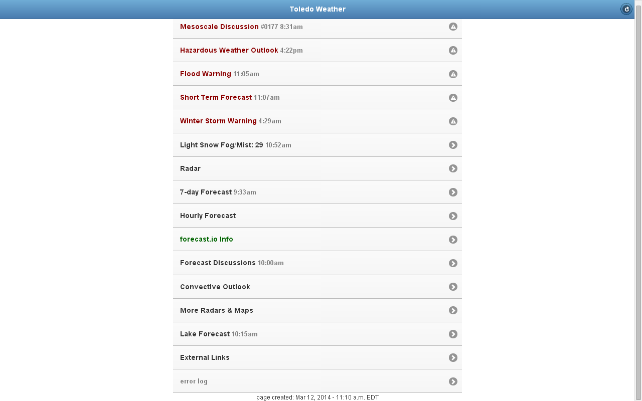
My Toledo weather web app home page at 11:10 a.m.
urgent - winter weather message
national weather service cleveland oh
133 pm edt wed mar 12 2014
.a wedge of drier air aloft and an initial wave of mixed
precipitation have limited snowfall totals this
morning...especially over the southeastern counties. the back
edge of the moderate snow is already over the toledo metro area.
it will move west to east across the forecast area early this
afternoon...accumulating an additional 1 to 3 inches in spots...
before tapering off to just flurries by late afternoon. blowing
snow will be a concern with wind gusts of 45 mph and greater. later
tonight the wind will shift from the northwest and initiate lake
effect snow in the lakeshore counties of northeastern oh and
northwestern pa.
ohz003-006>009-017>019-027-028-130000-
/o.con.kcle.ws.w.0004.000000t0000z-140313t0000z/
lucas-wood-ottawa-sandusky-erie oh-hancock-seneca-huron-wyandot-
crawford-
including the cities of...toledo...bowling green...port clinton...
fremont...sandusky...findlay...tiffin...norwalk...
upper sandusky...carey...bucyrus
133 pm edt wed mar 12 2014
...winter storm warning remains in effect until 8 pm edt this
evening...
- accumulations...snow accumulation of 4 to 8 inches.
- timing...the snow will be heaviest during the afternoon...then
become light by this evening.
- winds...north 20 to 25 mph with gusts up to 50 mph.
- impacts...blowing snow will make travel hazardous and slow
across the region. untreated surface will be slick.
- temperatures...in the lower 20s.
precautionary/preparedness actions...
a winter storm warning is issued when severe winter weather is
expected. heavy snow and/or ice will cause hazardous driving
conditions. if you will be traveling in the warning area you
should choose an alternate route if possible... or you should use
extreme caution if travel is unavoidable. stay tuned to noaa
weather radio for further details or updates.
fxus61 kcle 121806
afdcle
area forecast discussion
national weather service cleveland oh
206 pm edt wed mar 12 2014
synopsis...
a snow storm will impact the area today as low pressure tracks
northeast from the ohio valley to near new jersey by this evening.
high pressure over the northern plains will build across the central
great lakes on thursday...shifting to the southeastern states by
friday. a warm front will lift north across the area on friday ahead
of low pressure passing north of the great lakes.
&&
near term /through tonight/...
mixed precipitation has switched over to all snow from western cuyahoga
county and points west. moderate to heavy snow is falling over
the toledo/findlay area with visibilities reduced to a three-
quarters of a mile or less at times. unofficial and official reports
from toledo already indicate accumulating snow in excess of 4
inches. east of cleveland temps remain in the mid to upper 30s
except along the immediate lakeshore where temps are near
freezing. as a result spots like erie pa have switched over to
snow while youngstown continues to rain. by 16z all areas are
still on track to switch over to snow as cold air funnels in from
the north.
original discussion...a winter storm still on track to impact
the area today as low pressure tracks east southern ohio. main
changes to the forecast with the package include a downward
adjustment to snowfall totals in our southeastern counties. we are
continuing to monitor the need for a blizzard warning downwind of
lake erie but decided to hold off for now with some question about
how variable conditions will be and if we will see persist ant
visibilities below a quarter mile. slowed down the start time on
the eastern portion of the warnings/advisories given the warm air
in place to start the morning. also considered downgrading wayne
and morrow counties to the advisory given marginal snow amounts
but decided to leave in the warning given the wind and expected
poor visibilities.
water vapor imagery shows the primary features for this storm coming
together early this morning. shortwave energy over southern illinois
will lift northeast across the area ahead of a deepening trough
dropping south out of canada. temperatures dipping into the upper
30s/low 40s early this morning as precipitation closes in on the
area. two main areas of precipitation are observed...the area
spreading northeast across central ohio ahead of the approaching
shortwave and the area extending from chicago to northwest ohio
along the strengthening frontal circulation in the 750-500mb layer.
dry air in the low levels will be abruptly overcome as the low
slides eastward with moisture and lift also increase along the low
level frontal circulation. ingredients come together very nicely
across northwest ohio for a heavy snow event with the transition to
snow occurring as precipitation rates increase by 10-11z near
toledo. it will snow fairly heavy through early afternoon before
starting to decrease with the arrival of the mid-level trough this
afternoon. will continue with about a 5-8 inch snowfall.
fut her south and east the forecast is not as clear cut as the
mid-level dry slot wraps north into the system between 14-18z...just
as many locations are making the transition to snow. prefer a
surface low track slightly north of the nam...more in line with the
ric13/00z ukmet/00z cmc runs. the low level baroclinic zone will
tighten up ahead of the approaching low with the 850mb thermal
gradient as much as 6 degrees between cle-yng at 15z. increasing
northerly winds will help to cool the boundary layer making a
corridor of freezing rain/sleet likely from findlay northeast to
cleveland and youngstown before we transition to snow. could even
see this occur with good precipitation rates for an hour or more as
lift increases immediately ahead of the mid level dry slot.
fortunately ground/road temperatures have warmed up after the last
couple days of warm air and sun. thunderstorms have been approaching
indianapolis early this morning and the chance of thunderstorms
extends about as far north as central ohio before the trough deepens
and shifts the elevated instability to the southeast. after making
the transition to snow...we will see wrap around moisture fill back
in with a strong deformation axis over the eastern counties during
the afternoon...coincident with the mid-level front. so the heavy
snow will make it...it will just take until roughly 13z at cle...15z
at mfd...16z at gkj...17z at cak...18z at yng. with that
said...think the previous snowfall forecast was a little too high
across the southern portion of the forecast area and have lowered
accumulations by a couple inches.
the lake will have an affect on both snowfall and wind along the
lakeshore and for the snowbelt areas...with the heavier lake
enhanced snow holding on for a longer duration. although it takes
until this evening for the air mass to cool enough for pure lake
effect...the enhanced convergence downwind of the lake...strong low
level omega below 850mb...and lift over the climbing terrain will
boost snow totals into this evening for the snowbelt. will carry
between 1 and 5 inches for portions of the snowbelt this
evening...highest in nw pa. snow will taper off after midnight as
much drier air arrives and the lake effect shuts off.
temperatures will fall through the day today...reaching near 20
degrees by late afternoon and dipping into the single digits most
areas overnight. wind chills will fall below zero and may need a
wind chill advisory for crawford county pa.
&&
short term /thursday through thursday night/...
high pressure will build east across the area on thursday with dry
conditions. lowered high temperatures by a couple degrees after a
cold night into upper teens/near 20 most areas.
&&
long term /friday through tuesday/...
a warm front will lift north across the region on friday. expect
this boundary will have a hard time making it over lake erie so
there could end up being a decent temp gradient across the area.
have lowered temps a tad for nw oh where ample snow cover will still
be around. it appears best chances for precip during the period
will be friday night into saturday as a cold front dips south across
the region. by midday saturday most of the precip will be gone.
expect a mix of rain and snow will little accumulation. a cold
air mass will settle over the region for the second half of the
weekend and high temps will again struggle to get above freezing on
sunday. after that the models go out of agreement and confidence
will be low for the end of the long term period. for now will try
for dry weather for both monday and tuesday. another system could
impact the area just after the period ends. monday will be even
cooler than sunday with readings making a run for normal on
tuesday.
&&
aviation /18z wednesday through monday/...
the dry slot will slide east of the forecast area by mid afternoon
with another 3-5 hours of ifr snow and blowing snow moving east
across the area. the back edge of the snow will reach nw ohio
around 20z and move east of the area this evening with ceilings
improving to vfr from west to east tonight. strong north winds will
diminish this evening as high pressure builds down from canada.
increasing high clouds on thursday with winds backing toward the
southwest.
outlook...mvfr wednesday night...and lingering into thursday for
ne oh/nw pa. non vfr possible friday night into sunday.
&&
marine...
have bumped up the start time of the gale warning a couple of hours
otherwise only minor changes this morning. winds should peak around
midday and then slowly diminish during the afternoon. the day crew
may be able to get rid of the gale with the afternoon package. the
flow will become westerly on thursday and eventually sw thursday
night as a surface ridges crosses the lake. the next thing to worry
about will be a cold front which will cross the lake friday night.
winds will return to the w or nw at that time. high pressure will
build over the lake from the nw over the weekend causing the flow to
take on a northerly component. expect the ice fields on the lake to
do a lot of shifting today.
&&
cle watches/warnings/advisories...
oh...winter storm warning until 2 am edt thursday for ohz011>014-
089.
winter weather advisory until 8 pm edt this evening for
ohz020>023-029>033-036>038-047.
winter storm warning until 8 pm edt this evening for ohz003-
006>010-017>019-027-028.
winter weather advisory from 8 pm this evening to 2 am edt
thursday for ohz010.
pa...winter storm warning until 2 am edt thursday for paz001>003.
marine...gale warning until 8 pm edt this evening for lez061-142>149-
162>169.
&&
$$
synopsis...kec
near term...kec/mayers
short term...kec
long term...kubina
aviation...kosarik
marine...kubina
My comment at TT
I tallied 7.75 inches of snowfall today by 1:10 pm. That's nearly 8 inches of snow in just over 7 hours. Impressive, especially for a higher moisture snowfall. The temp remained around 30 degrees nearly the entire time.
By 1:30 pm, the snow intensity decreased to very light. We "should" only have some light snow this afternoon with little additional accumulation.
This will be the fifth snowstorm this season that has dropped at least 8 inches of snowfall. Or the sixth storm. I've lost track. I'll have to look back through this thread.
Before today's snow, our yard was still snow covered with at least two inches of ice pack. But officially, Toledo Express Airport recorded no snow depth yesterday, March 11. So the snow cover streak began on Jan 1 and ended on Mar 10. We had less blowing snow in the city for some of the earlier storms, so maybe the snow piled up better in our neighborhoods.
At 2:00 pm, it's still windy. The temp has started to fall. It will be in the single digits to near zero by daybreak tomorrow. That should seal up this thick layer of wet snow.
I'm guessing that by mid to late next week, our yard will be free of snow, except for the shoveled piles.
posted by jr on Mar 12, 2014 at 02:36:48 pm
Toledo Blade story updated around 3:00 p.m.:
Weather conditions that are paralyzing the Toledo area will be evaluated within the next hour today to determine whether or not to keep in place a Level 3 snow emergency, Lucas County Sheriff John Tharp said.Sheriff Tharp, who declared the Level 3 emergency at 7 a.m. today, said concerns about strong, gusty winds would enter into any decision on downgrading to Level 2. "Right now I have concerns about the wind," he said.
Both westbound and eastbound portions of the Turnpike were shut down after multiple tractor-trailer rigs overturned in multiple areas stretching from Ottawa County into Erie County.
U.S. 24 near the Lucas/Henry County line is closed due to the weather. Officials said it is impassable because of the wind and snow.
Sheriff Tharp said State Rt. 2 in eastern Lucas County and into Ottawa County is treacherous. He said many accidents and vehicles going off the roadway into ditches have been reported.
As of 2 p.m. today, the total of new snow accumulation at Toledo Express Airport was 6.5 inches, bringing the season record-breaking amount to 84.3 inches, said Kristen Schepel, of the National Weather Service.
We must have received heavier snow bands in West Toledo. At 1:00 p.m, I measured over 7 inches of snow on the top of my car. Some of the snowfall landing on a spot like that would have been blown away and not replaced.
84.3 inches of total snowfall thus far at TOL, eh?
On average, Toledo Express Airport receives nearly 4 inches of snow after March 12.
TOL averages only about 6 inches of snowfall for the entire month of March.
Through today, March 12, nearly 11 inches of snow has accumulated at TOL this month.
It seems that TOL has a good shot of reaching 90 total inches of snowfall.
8.0 inches of snow fell in West Toledo today, with nearly all of it falling in about 7 to 7.5 hr period from around 6:00 a.m. to 1:10 p.m.
I think Toledo Express Airport only recorded 6.5 inches.
Toledo 7-day forecast
Last Update: Mar 12, 2014 6:25 pm
Tonight: Widespread blowing snow before 11pm. Partly cloudy, with a low around -3. Wind chill values as low as -10. Northwest wind 6 to 16 mph.
Thursday: Sunny, with a high near 20. Wind chill values as low as -12. West wind 7 to 9 mph.
Thursday Night: Mostly cloudy, with a low around 18. Southwest wind 6 to 11 mph.
Friday: Mostly sunny, with a high near 44. Breezy, with a south wind 13 to 20 mph.
Friday Night: A chance of rain and snow showers before midnight, then a chance of snow showers. Mostly cloudy, with a low around 30. West wind 10 to 15 mph. Chance of precipitation is 30%. New precipitation amounts of less than a tenth of an inch possible.
Saturday: A slight chance of snow showers, mixing with rain after 9am, then gradually ending. Partly sunny, with a high near 39. Chance of precipitation is 20%.
Saturday Night: Mostly cloudy, with a low around 16.
Sunday: Partly sunny, with a high near 27.
Sunday Night: Partly cloudy, with a low around 10.
Monday: Mostly sunny, with a high near 29.
Monday Night: Mostly cloudy, with a low around 16.
Tuesday: Partly sunny, with a high near 41.
Tuesday Night: A chance of rain and snow showers. Mostly cloudy, with a low around 30. Chance of precipitation is 30%.
Wednesday: A chance of rain showers. Mostly cloudy, with a high near 44. Chance of precipitation is 30%.
forecast.io hi-lo temp predictions for toledo as of 8:08 p.m:
- tomorrow, Thu, Mar 13 : 22 and -3
- Fri, Mar 14 : 39 and 24
- Sat, Mar 15 : 36 and 27
- Sun, Mar 16 : 27 and 19
- Mon, Mar 17 : 31 and 15
- Tue, Mar 18 : 48 and 24
- Wed, Mar 19 : 51 and 39
hazardous weather outlook
national weather service cleveland oh
832 pm edt wed mar 12 2014
ohz003-006>009-017>019-027>033-036>038-047-140045-
lucas-wood-ottawa-sandusky-erie oh-hancock-seneca-huron-wyandot-
crawford-richland-ashland-wayne-stark-mahoning-marion-morrow-holmes-
knox-
832 pm edt wed mar 12 2014
this hazardous weather outlook is for north central
ohio...northeast ohio and northwest ohio.
.day one...tonight.
some isolated ice jam flooding may occur through tonight. some
blowing and drifting snow may also continue into the night.
.days two through seven...thursday through tuesday.
no hazardous weather is expected at this time.
.spotter information statement...
spotter activation is not expected at this time.
From JR's : articles
5765 words - 35510 chars
- 32 min read
created on
updated on
- #
source
- versions
Related articles
Severe weather threat for Sun, Nov 17, 2013 - Nov 18, 2013
Nov 17, 2013 Toledo area weather notes - Mar 03, 2014
Posts related to Nov 17, 2013 severe weather - Nov 21, 2013
Toledo area weather for early December 2013 - Dec 05, 2013
Mon, Dec 9, 2013 winter storm forecast for Sat, Dec 14 - Dec 14, 2013
more >>