Toledo Weather - Tue, Apr 15, 2014
hazardous weather outlook
national weather service cleveland oh
505 am edt tue apr 15 2014
ohz003-006>014-017>020-027>030-036-037-089-paz001>003-160915-
lucas-wood-ottawa-sandusky-erie oh-lorain-cuyahoga-lake-geauga-
ashtabula inland-hancock-seneca-huron-medina-wyandot-crawford-
richland-ashland-marion-morrow-ashtabula lakeshore-northern erie-
southern erie-crawford pa-
505 am edt tue apr 15 2014
this hazardous weather outlook is for north central
ohio...northeast ohio...northwest ohio and northwest pennsylvania.
.day one...today and tonight.
most areas will receive between 1 and 3 inches of wet snow today...
mainly on grassy and elevated surfaces.
.days two through seven...wednesday through monday.
no hazardous weather is expected at this time.
.spotter information statement...
spotter activation is not expected at this time although snowfall
reports will be appreciated.
Apr 15, 2014 5:52 am
Weather : Mostly Cloudy
Temperature : 28 F
Humidity : 85%
Wind Speed : WNW 10 mph
Barometer : 29.87 in
Dewpoint: 24 F
Visibility : 10.00 statute miles
Wind Chill : 19 F
Toledo 7-day forecast
Last Update: Apr 15, 2014 3:31 am
Today: A chance of snow, mainly before 10am. Mostly cloudy, with a high near 36. Northwest wind 16 to 18 mph. Chance of precipitation is 50%. Total daytime snow accumulation of less than one inch possible.
Tonight: Partly cloudy, with a low around 22. Northwest wind 5 to 10 mph becoming light west after midnight.
Wednesday: Mostly sunny, with a high near 47. Light south wind increasing to 9 to 14 mph in the morning.
Wednesday Night: Partly cloudy, with a low around 33. Southeast wind 6 to 11 mph.
Thursday: Mostly sunny, with a high near 62. Southwest wind 8 to 13 mph.
Thursday Night: Mostly cloudy, with a low around 46.
Friday: A chance of showers after noon. Mostly cloudy, with a high near 59. Chance of precipitation is 30%.
Friday Night: A chance of showers. Cloudy, with a low around 42. Chance of precipitation is 40%.
Saturday: Partly sunny, with a high near 54.
Saturday Night: Mostly cloudy, with a low around 34.
Sunday: A chance of showers. Partly sunny, with a high near 56. Chance of precipitation is 30%.
Sunday Night: A chance of showers. Mostly cloudy, with a low around 36. Chance of precipitation is 30%.
Monday: A chance of showers. Partly sunny, with a high near 59. Chance of precipitation is 30%.
fxus61 kcle 150819
afdcle
area forecast discussion
national weather service cleveland oh
419 am edt tue apr 15 2014
synopsis...
low pressure over western pennsylvania will move northeast across
new england today with colder air settling over the region. high
pressure will build overhead this evening then to the east coast
on wednesday. low the pressure will track through the upper great
lakes early thursday lifting a warm front north across the area.
&&
near term /until 6 pm this evening/...
we are seeing more sites transition to snow early this morning as
the wave of low pressure riding northeast along the front shifts
into pennsylvania and temperatures continue to cool. as of 3 am the
rain/snow line extended from roughly lima to mansfield to lorain.
this is expected to shift eastward with most sites switching over to
snow by 8 am. radars to our west show precipitation shifting
eastward and ending while enhancement is being observed from central
kentucky into sw ohio. this is occuring where upper level divergence
associated with a 150 knot jet streak aloft is enhancing lift and is
expected to slide across north central ohio over the next couple
hours. the toledo area will likely end up on the western fringe of
this area of enhancement with only another inch or two of snow
expected...while areas in a corridor extending from marion to
sandusky could see 1-3 inches of snow fall through 7 am. although
ground temperatures have warmed over the last couple days...precip
rates should be good enough to see even a slushy coating of snow on
roadways. the greater cleveland and erie pa areas will also be
seeing the transition to snow during the morning rush and road
conditions will really just depend on how hard it is snowing.
with time we will see the mid-level dry-slot spreading in from the
west with precip rates starting to decrease. mid-level moisture
strips away during the morning hours but models are advertising a
fair amount of low level convergence occuring downwind of lake erie
with lake effect snow showers lingering into this afternoon for the
snow belt. hi-res models are even hinting at a lake huron connection
although not sure if there is really sufficient time for this to set
up. generally expecting 1-3 inches of snow for today across the snow
belt...will accumulations under an inch farther south towards
canton.
eastern areas experiencing their high temperature for the day this
morning while western areas may climb a few degrees this
afternoon...especially if there are any brief breaks in the clouds.
otherwise expecting any breaks to fill in quickly with mostly cloudy
skies.
&&
short term /6 pm this evening through friday night/...
skies are expected to clear out of all areas tonight as high
pressure builds overhead. this will make for a cold night with light
winds and favorable radiational cooling. temperatures will bottom
out in the teens in porions of nw pa and ne ohio while areas closer
to lake erie and nw ohio will only dip to the low 20s. youngstown is
forecast to dip to around 17 which would break the record low for
april 16th of 21 degrees from 1980. not expecting other locations to
be that close to the records.
a warming trend will get underway again through midweek as the flow
shifts around to the south and low pressure tracks through the upper
great lakes early thursday. temperatures will recover to near 60
degrees again on thursday with mostly sunny skies.
moisture will be on the increase towards friday ahead of the next
trough. held onto the low pops in the forecast with temperatures
dropping off friday night with the passage of the next cold front.
&&
long term /saturday through monday/...
long term begins saturday with high pressure extending south across
the area. an upper trof will be over the area in the morning but
should be drifting east through the day as drier air and weak
ridging move in. sunday night and monday models hinting at rain
chances as moisture moves in from the west but confidence low with
model differences fairly sizable. temps look warm enough for
precip to be rain through the period.
&&
aviation /06z tuesday through saturday/...
cold air continues to sweep into the area from the northwest
overnight behind a cold front now to our east. widespread rain
over much of the area will turn to snow overnight before ending
during the day tuesday. in fact snow is already occurring across
nwrn ohio and at ktol. widespread ifr or lower conditions across
the area overnight will lift to mvfr from the west towards morning
lifting to vfr at ktol 12-15z as drier air moves in. should be vfr
at kcle 20-22z and at keri by 00z.
outlook...non vfr possible by saturday.
&&
marine...
will continue with the small craft advisory today and extend it into
tonight through 3am. for today north/northwest winds will increase
to 20 to 25 knots or so in the tight gradient between high pressure
to our west and low pressure in new england. the winds will taper
off tonight however as the high builds in. wednesday will begin with
the high across the lake and low pressure over south dakota moving
east. the low will reach wisconsin by wednesday evening as the high
drifts to new england. the low will cross eastern lake superior
thursday weakening as it does. friday and friday night weak low
pressure will move through the ohio valley. high pressure will
build across the lake saturday. after tonight... expect winds to be
generally light under 15 knots through the period with waves
generally 2 feet or less.
&&
cle watches/warnings/advisories...
oh...none.
pa...none.
marine...small craft advisory until 3 am edt wednesday for lez142>149.
&&
$$
synopsis...kec
near term...kec
short term...kec
long term...tk
aviation...tk
marine...tk
fzus51 kcle 150734
nshcle
nearshore marine forecast
national weather service cleveland oh
334 am edt tue apr 15 2014
for waters within five nautical miles of shore on lake erie
lez142>146-151430-
maumee bay to reno beach oh-reno beach to the islands oh-
the islands to vermilion oh-vermilion to avon point oh-
avon point to willowick oh-
334 am edt tue apr 15 2014
..small craft advisory in effect through late tonight...
today...northwest winds 15 to 25 knots. snow this morning...then a
chance of snow showers this afternoon. waves in ice free areas 4 to
6 feet building to 5 to 7 feet.
tonight...northwest winds 10 to 20 knots becoming west and
diminishing to 10 knots or less. mostly cloudy in the evening...then
becoming partly cloudy. waves 5 to 7 feet subsiding to 1 to 3 feet.
wednesday...south winds 10 knots or less becoming southeast 5 to
15 knots. mostly sunny. waves 2 feet or less.
wednesday night...southeast winds 5 to 15 knots. partly cloudy.
waves 1 to 3 feet.
waves are for ice free areas.
see lake erie open lakes forecast for thursday through saturday.
the water temperature off toledo is 45 degrees...off cleveland 40
degrees and off erie 39 degrees.
$$
lez147>149-151430-
willowick to geneva-on-the lake oh-geneva-on-the-lake to conneaut oh-
conneaut oh to ripley ny-
334 am edt tue apr 15 2014
..small craft advisory in effect through late tonight...
today...northwest winds 15 to 25 knots. snow and rain this
morning...then snow showers this afternoon. waves in ice free areas
5 to 7 feet.
tonight...west winds 10 to 20 knots becoming northwest 5 to
15 knots. mostly cloudy. a chance of snow showers in the evening.
waves 5 to 7 feet subsiding to 2 to 4 feet.
wednesday...southwest winds 10 knots or less becoming east. sunny.
waves 1 to 3 feet subsiding to 2 feet or less.
wednesday night...east winds 5 to 15 knots becoming southeast.
partly cloudy. waves 2 feet or less.
waves are for ice free areas.
see lake erie open lakes forecast for thursday through saturday.
the water temperature off toledo is 45 degrees...off cleveland 40
degrees and off erie 39 degrees.
$$
Wundermaps Apr 13, 14, 15
Sun evening, Apr 13

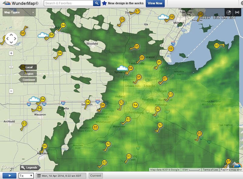
Mon morning, Apr 14: I did not think to fire up the laptop and Wundermap around 7:30 a.m., when I got up. I first checked Wundermap around 8:00 a.m., and the WTWS reported 70 degrees. The temps dropped a few degrees quickly after 8:00 a.m. after the front moved through.
Tue morning, Apr 15

From JR's : articles
1754 words - 10682 chars
- 9 min read
created on
updated on
- #
source
- versions
Related articles
Severe weather threat for Sun, Nov 17, 2013 - Nov 18, 2013
Nov 17, 2013 Toledo area weather notes - Mar 03, 2014
Posts related to Nov 17, 2013 severe weather - Nov 21, 2013
Toledo area weather for early December 2013 - Dec 05, 2013
Mon, Dec 9, 2013 winter storm forecast for Sat, Dec 14 - Dec 14, 2013
more >>