You're viewing old version number 2. - Current version
Weather notes for Jan 30, 2015
As of early Fri morning, Jan 30, the last two GFS computer model runs have forecast the Toledo area to receive between 3 and 6+ inches of snowfall by daybreak Monday. At the moment, we're on the forecast border or the northern edge of the heavier snowfall range.
Findlay and Lima should receive several inches. Monroe might receive 2 to 3 inches. If the low pressure tracks a little further north, then Toledo will receive its biggest snowfall of the season.
This morning's snow forecast maps and the area forecast discussion predict the heavier snowfall to occur over the middle third of Ohio or along and south of Route 30.
Regardless, it will be wintry on Sunday in Toledo. We'll receive at least a few inches of snowfall. Our temps will be cold, around 20 degrees, so the snow will probably be light and fluffy. It's forecast to be windy, so blowing snow may be a problem.
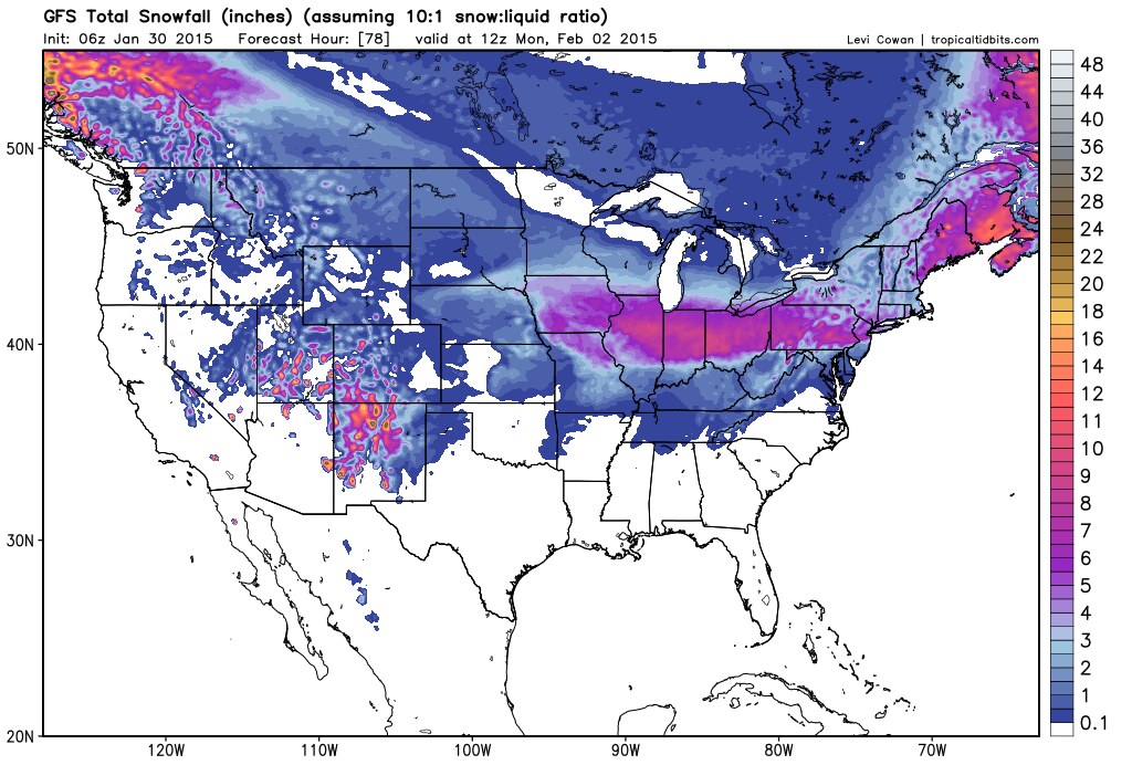

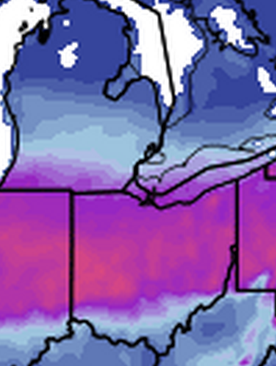
Image-heavy post.
Friday afternoon info from the three regional NWS offices:
Northern Indiana NWS, which covers northwest Ohio counties west of Lucas County.

Detroit/Pontiac NWS
Total snowfall by 7:00 a.m., Mon, Feb 2


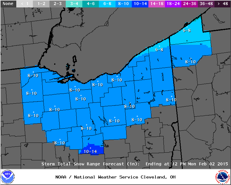
Cleveland NWS
Total snowfall by Noon on Monday.
Weather Prediction Center
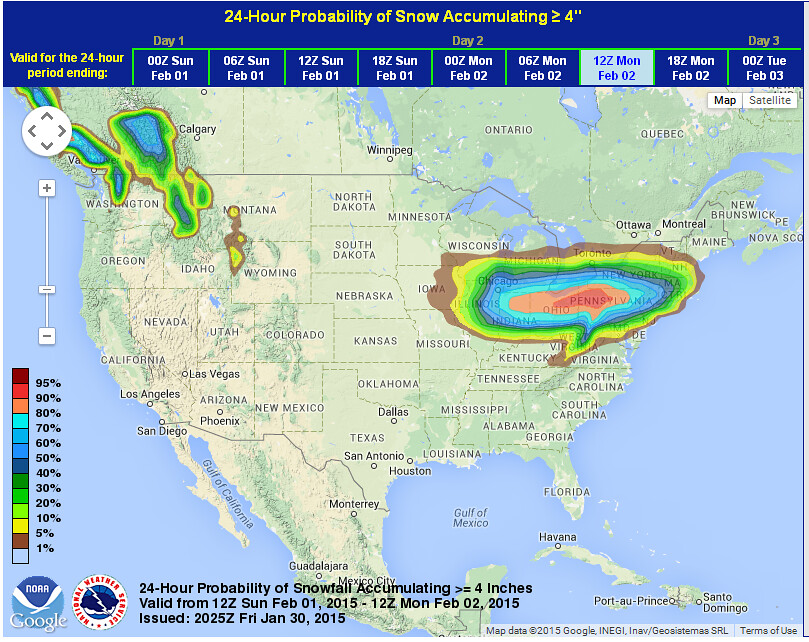
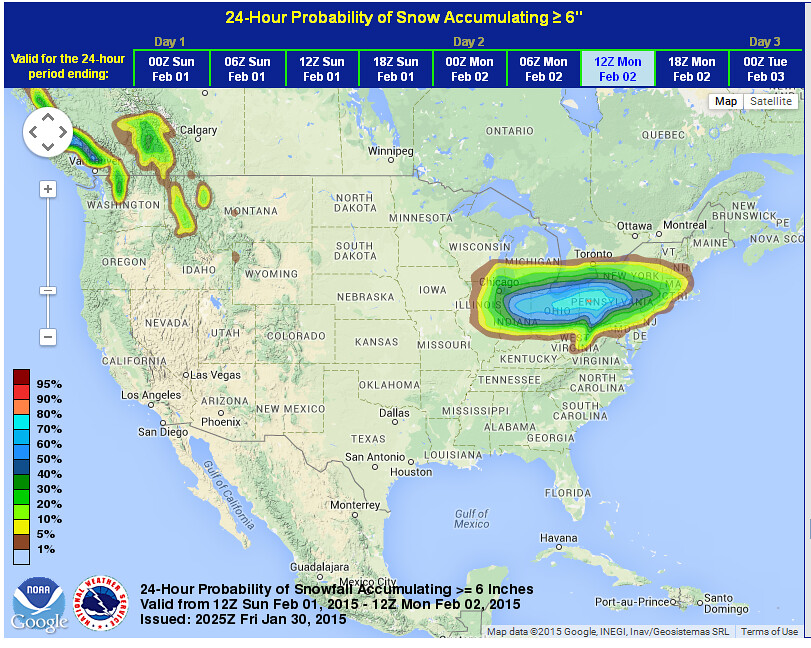
Latest snowfall probability forecast maps, issued at 3:25 p.m., Fri, Jan 30.
For the Toledo area:
- 70 to 90 percent chance of at least 4 inches of snow
- 40 to 70 percent chance of at least 6 inches of snow
- 20 to 40 percent chance of at least 8 inches of snow

From JR's : articles
255 words - 1500 chars
- 1 min read
created on
updated on
- #
source
- versions
Related articles
Severe weather threat for Sun, Nov 17, 2013 - Nov 18, 2013
Nov 17, 2013 Toledo area weather notes - Mar 03, 2014
Posts related to Nov 17, 2013 severe weather - Nov 21, 2013
Toledo area weather for early December 2013 - Dec 05, 2013
Mon, Dec 9, 2013 winter storm forecast for Sat, Dec 14 - Dec 14, 2013
more >>