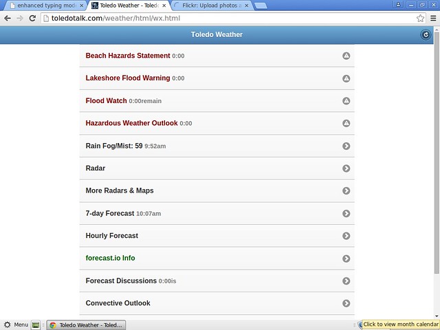
Toledo weather sat jun 27 2015
lakeshore hazard message
national weather service cleveland oh
1159 pm edt fri jun 26 2015
...strong northeast winds to 35 knots saturday may result in
lakeshore flooding...
ohz003-007-009-271200-
/o.new.kcle.ls.a.0001.150627t1100z-150628t0200z/
/o.con.kcle.bh.s.0004.150627t0800z-150628t1300z/
lucas-ottawa-erie oh-
1159 pm edt fri jun 26 2015
...beach hazards statement remains in effect from 4 am edt
saturday through sunday morning...
...lakeshore flood watch in effect from 7 am edt saturday through
saturday evening...
the national weather service in cleveland has issued a lakeshore
flood watch...which is in effect from 7 am edt saturday through
saturday evening.
- lake shore flooding...strong northeast winds to 35 knots will
develop saturday and may result in flooding along the lakeshore.
- hazards...coastal flooding and dangerous swimming conditions.
- timing...dangerous swimming conditions will occur from 4 am
saturday morning through sunday morning. the coastal flooding
threat will begin at 7am saturday morning and end at 10pm
saturday evening.
- location...the lakeshore from from lucas county to cuyahoga
county
- impacts...large waves will cause rip currents to develop.
rising water levels due to driving winds may result flooding
along the lakeshore.
precautionary/preparedness actions...
swimming risk exists saturday. the combination of wind and or
waves will make for potentially dangerous conditions for swimmers
including the risk of rip currents. follow the instruction of
local authorities or stay out of the water.
a lakeshore flood watch means lakeshore flooding will occur if
weather develops as expected. people in the watch area should be
ready to move to safe ground if flooding occurs or if warnings
are issued. stay tuned to local radio...television...or noaa
weather radio to keep informed of the latest situation.
&&
$$
beach hazards statement
lakeshore hazard message
national weather service cleveland oh
1159 pm edt fri jun 26 2015
...strong northeast winds to 35 knots saturday may result in
lakeshore flooding...
ohz003-007-009-271200-
/o.new.kcle.ls.a.0001.150627t1100z-150628t0200z/
/o.con.kcle.bh.s.0004.150627t0800z-150628t1300z/
lucas-ottawa-erie oh-
1159 pm edt fri jun 26 2015
...beach hazards statement remains in effect from 4 am edt
saturday through sunday morning...
...lakeshore flood watch in effect from 7 am edt saturday through
saturday evening...
the national weather service in cleveland has issued a lakeshore
flood watch...which is in effect from 7 am edt saturday through
saturday evening.
- lake shore flooding...strong northeast winds to 35 knots will
develop saturday and may result in flooding along the lakeshore.
- hazards...coastal flooding and dangerous swimming conditions.
- timing...dangerous swimming conditions will occur from 4 am
saturday morning through sunday morning. the coastal flooding
threat will begin at 7am saturday morning and end at 10pm
saturday evening.
- location...the lakeshore from from lucas county to cuyahoga
county
- impacts...large waves will cause rip currents to develop.
rising water levels due to driving winds may result flooding
along the lakeshore.
precautionary/preparedness actions...
swimming risk exists saturday. the combination of wind and or
waves will make for potentially dangerous conditions for swimmers
including the risk of rip currents. follow the instruction of
local authorities or stay out of the water.
a lakeshore flood watch means lakeshore flooding will occur if
weather develops as expected. people in the watch area should be
ready to move to safe ground if flooding occurs or if warnings
are issued. stay tuned to local radio...television...or noaa
weather radio to keep informed of the latest situation.
&&
$$
flood watch
flood watch
national weather service cleveland oh
927 pm edt fri jun 26 2015
...flood threat saturday from an unseasonably strong storm...
a strong low pressure system will develop tonight and track up
the ohio valley and deepen over northern ohio on saturday. rain
is expected to overspread the region tonight and become heavy
toward morning. moderate to heavy rain is expected over most of
the region on saturday. the low will be slow moving...and an
excessive amount of rain will fall across the area within a
relatively short time frame.
ohz003-006>014-017>023-027>033-036>038-047-089-paz001>003-270930-
/o.con.kcle.fa.a.0003.000000t0000z-150628t0800z/
/00000.0.er.000000t0000z.000000t0000z.000000t0000z.oo/
lucas-wood-ottawa-sandusky-erie oh-lorain-cuyahoga-lake-geauga-
ashtabula inland-hancock-seneca-huron-medina-summit-portage-
trumbull-wyandot-crawford-richland-ashland-wayne-stark-mahoning-
marion-morrow-holmes-knox-ashtabula lakeshore-northern erie-
southern erie-crawford pa-
including the cities of...toledo...bowling green...port clinton...
fremont...sandusky...lorain...cleveland...mentor...chardon...
jefferson...findlay...tiffin...norwalk...medina...akron...
ravenna...warren...upper sandusky...carey...bucyrus...mansfield...
ashland...wooster...canton...youngstown...marion...mount gilead...
millersburg...mount vernon...ashtabula...erie...edinboro...
meadville
927 pm edt fri jun 26 2015
...flood watch remains in effect through late saturday night...
the flood watch continues for
- portions of ohio and northwest pennsylvania...including the
following areas...in ohio...ashland...ashtabula inland...
ashtabula lakeshore...crawford...cuyahoga...erie oh...geauga...
hancock...holmes...huron...knox...lake...lorain...lucas...
mahoning...marion...medina...morrow...ottawa...portage...
richland...sandusky...seneca...stark...summit...trumbull...
wayne...wood and wyandot. in northwest pennsylvania...crawford
pa...northern erie and southern erie.
- through late saturday night
- a slow moving low pressure will deepen across the area then
linger through sunday...bringing steady rains. in general a
widespread 1.5 to 3 inches of rain will fall by late saturday
night with locally higher amounts in thunderstorms. with
saturated soil...expect a rapid rise of creeks and even rivers
on saturday.
- flooding...especially in urban areas...can occur very
quickly...primarily at underpasses and poor drainage areas.
quick rises on area creeks and streams will be likely from the
heavy rainfall.
precautionary/preparedness actions...
a flood watch means there is a potential for flooding based on
current forecasts. you should monitor later forecasts and be
alert for possible flood warnings. those living in areas prone to
flooding should be prepared to take action should flooding
develop. stay tuned to weather radio for further details or
updates
&&
$$
hazardous weather outlook
hazardous weather outlook
national weather service cleveland oh
924 pm edt fri jun 26 2015
ohz003-007-009>011-280130-
lucas-ottawa-erie oh-lorain-cuyahoga-
924 pm edt fri jun 26 2015
...flood watch in effect through late saturday night...
...beach hazards statement in effect from 4 am edt saturday through
sunday morning...
this hazardous weather outlook is for north central
ohio...northeast ohio and northwest ohio.
.day one...tonight.
please listen to noaa weather radio or go to weather.gov on the
internet for more information about the following hazards.
flood watch.
beach hazards statement.
.days two through seven...saturday through thursday.
please listen to noaa weather radio or go to weather.gov on the
internet for more information about the following hazards.
flood watch.
beach hazards statement.
.spotter information statement...
spotter activation is not expected at this time.
$$
Toledo Weather
Back
lakeshore hazard message
national weather service cleveland oh
353 am edt sat jun 27 2015
...strong northeast winds to 35 knots saturday may result in
lakeshore flooding...
ohz003-007-009-271600-
/o.upg.kcle.ls.a.0001.150627t1100z-150628t0200z/
/o.new.kcle.ls.w.0001.150627t1200z-150628t0200z/
/o.ext.kcle.bh.s.0004.150627t1300z-150628t1300z/
lucas-ottawa-erie oh-
353 am edt sat jun 27 2015
...lakeshore flood warning in effect from 8 am this morning to
10 pm edt this evening...
...beach hazards statement now in effect from 9 am edt this
morning through sunday morning...
the national weather service in cleveland has issued a lakeshore
flood warning...which is in effect from 8 am this morning to
10 pm edt this evening. the lakeshore flood watch is no longer in
effect.
- lake shore flooding...strong northeast winds to 35 knots will
develop saturday and may result in flooding along the
lakeshore.
- hazards...coastal flooding and dangerous swimming conditions.
- timing...dangerous swimming conditions will occur from 4 am
saturday morning through sunday morning. the coastal flooding
threat will begin at 8am saturday morning and end at 10pm
saturday evening.
- location...the lakeshore from from lucas county to erie county
ohio
- impacts...large waves will cause rip currents to develop.
rising water levels due to driving winds may result flooding
along the lakeshore.
precautionary/preparedness actions...
swimming risk exists saturday. the combination of wind and or
waves will make for potentially dangerous conditions for swimmers
including the risk of rip currents. follow the instruction of
local authorities or stay out of the water.
a lakeshore flood warning means lakeshore flooding is occurring,
is imminent, or is expected to occur within the next 12 hours.
people in the warning area should take immediate action to
protect life and property. listen to local radio...television...
or noaa weather radio for further information.
swimming risk exists today. the combination of wind and or waves
will make for potentially dangerous conditions for swimmers
including the risk of rip currents. follow the instruction of
local authorities or stay out of the water.
flood watch
national weather service cleveland oh
432 am edt sat jun 27 2015
...flood threat continues into tonight...
low pressure will strengthen as it slowly moves into northern
ohio today. widespread rain has spread into the area this morning and
will remain steady across extreme northwest ohio. showers and
thunderstorms are expected to develop across northeast ohio by
early afternoon with high rainfall rates possible. much of the
area will receive between one and a half and two and a half inches
of rain through tonight. this amount of rainfall will be excessive
and lead to flooding in some areas through tonight...especially
those that have received high amounts of rain over the last week.
ohz003-006>014-017>023-027>033-036>038-047-089-paz001>003-271645-
/o.con.kcle.fa.a.0003.000000t0000z-150628t0800z/
/00000.0.er.000000t0000z.000000t0000z.000000t0000z.oo/
lucas-wood-ottawa-sandusky-erie oh-lorain-cuyahoga-lake-geauga-
ashtabula inland-hancock-seneca-huron-medina-summit-portage-
trumbull-wyandot-crawford-richland-ashland-wayne-stark-mahoning-
marion-morrow-holmes-knox-ashtabula lakeshore-northern erie-
southern erie-crawford pa-
including the cities of...toledo...bowling green...port clinton...
fremont...sandusky...lorain...cleveland...mentor...chardon...
jefferson...findlay...tiffin...norwalk...medina...akron...
ravenna...warren...upper sandusky...carey...bucyrus...mansfield...
ashland...wooster...canton...youngstown...marion...mount gilead...
millersburg...mount vernon...ashtabula...erie...edinboro...
meadville
432 am edt sat jun 27 2015
...flood watch remains in effect through late tonight...
the flood watch continues for
- portions of ohio and northwest pennsylvania...including the
following areas...in ohio...ashland...ashtabula inland...
ashtabula lakeshore...crawford...cuyahoga...erie oh...geauga...
hancock...holmes...huron...knox...lake...lorain...lucas...
mahoning...marion...medina...morrow...ottawa...portage...
richland...sandusky...seneca...stark...summit...trumbull...
wayne...wood and wyandot. in northwest pennsylvania...crawford
pa...northern erie and southern erie.
- through late tonight
- a slow moving low pressure system will strengthen across the
area today then slowly exit to the east on sunday. steady
rainfall is expected in northwest ohio with periods of showers
and thunderstorms in northeast ohio. widespread rainfall of 1.5
to 2.5 inches of rain will fall by late tonight. given the
recent wet conditions...flooding will likely develop in some
areas.
- flooding...especially in urban areas...can occur very
quickly...primarily at underpasses and poor drainage areas.
rises on area creeks and streams will occur and may be running
at high capacity from the heavy rainfall.
precautionary/preparedness actions...
a flood watch means there is a potential for flooding based on
current forecasts. you should monitor later forecasts and be
alert for possible flood warnings. those living in areas prone to
flooding should be prepared to take action should flooding
develop. stay tuned to weather radio for further details or
updates
&&
$$
hazardous weather outlook
hazardous weather outlook
national weather service cleveland oh
508 am edt sat jun 27 2015
ohz003-007-009-280915-
lucas-ottawa-erie oh-
508 am edt sat jun 27 2015
...flood watch in effect through late tonight...
...lakeshore flood warning in effect until 10 pm edt this evening...
...beach hazards statement in effect from this evening through
sunday morning...
this hazardous weather outlook is for north central ohio and
northwest ohio.
.day one...today and tonight.
please listen to noaa weather radio or go to weather.gov on the
internet for more information about the following hazards.
flood watch.
lakeshore flood warning.
beach hazards statement.
.days two through seven...sunday through friday.
please listen to noaa weather radio or go to weather.gov on the
internet for more information about the following hazards.
beach hazards statement.
.spotter information statement...
spotter activation may be needed. reports of rainfall or flooding
are appreciated.
$$
beach hazards statement
lakeshore hazard message
national weather service cleveland oh
353 am edt sat jun 27 2015
...strong northeast winds to 35 knots saturday may result in
lakeshore flooding...
ohz003-007-009-271600-
/o.upg.kcle.ls.a.0001.150627t1100z-150628t0200z/
/o.new.kcle.ls.w.0001.150627t1200z-150628t0200z/
/o.ext.kcle.bh.s.0004.150627t1300z-150628t1300z/
lucas-ottawa-erie oh-
353 am edt sat jun 27 2015
...lakeshore flood warning in effect from 8 am this morning to
10 pm edt this evening...
...beach hazards statement now in effect from 9 am edt this
morning through sunday morning...
the national weather service in cleveland has issued a lakeshore
flood warning...which is in effect from 8 am this morning to
10 pm edt this evening. the lakeshore flood watch is no longer in
effect.
- lake shore flooding...strong northeast winds to 35 knots will
develop saturday and may result in flooding along the
lakeshore.
- hazards...coastal flooding and dangerous swimming conditions.
- timing...dangerous swimming conditions will occur from 4 am
saturday morning through sunday morning. the coastal flooding
threat will begin at 8am saturday morning and end at 10pm
saturday evening.
- location...the lakeshore from from lucas county to erie county
ohio
- impacts...large waves will cause rip currents to develop.
rising water levels due to driving winds may result flooding
along the lakeshore.
precautionary/preparedness actions...
swimming risk exists saturday. the combination of wind and or
waves will make for potentially dangerous conditions for swimmers
including the risk of rip currents. follow the instruction of
local authorities or stay out of the water.
a lakeshore flood warning means lakeshore flooding is occurring,
is imminent, or is expected to occur within the next 12 hours.
people in the warning area should take immediate action to
protect life and property. listen to local radio...television...
or noaa weather radio for further information.
swimming risk exists today. the combination of wind and or waves
will make for potentially dangerous conditions for swimmers
including the risk of rip currents. follow the instruction of
local authorities or stay out of the water.
&&
$$
lakeshore flood warning
lakeshore hazard message
national weather service cleveland oh
353 am edt sat jun 27 2015
...strong northeast winds to 35 knots saturday may result in
lakeshore flooding...
ohz003-007-009-271600-
/o.upg.kcle.ls.a.0001.150627t1100z-150628t0200z/
/o.new.kcle.ls.w.0001.150627t1200z-150628t0200z/
/o.ext.kcle.bh.s.0004.150627t1300z-150628t1300z/
lucas-ottawa-erie oh-
353 am edt sat jun 27 2015
...lakeshore flood warning in effect from 8 am this morning to
10 pm edt this evening...
...beach hazards statement now in effect from 9 am edt this
morning through sunday morning...
the national weather service in cleveland has issued a lakeshore
flood warning...which is in effect from 8 am this morning to
10 pm edt this evening. the lakeshore flood watch is no longer in
effect.
- lake shore flooding...strong northeast winds to 35 knots will
develop saturday and may result in flooding along the
lakeshore.
- hazards...coastal flooding and dangerous swimming conditions.
- timing...dangerous swimming conditions will occur from 4 am
saturday morning through sunday morning. the coastal flooding
threat will begin at 8am saturday morning and end at 10pm
saturday evening.
- location...the lakeshore from from lucas county to erie county
ohio
- impacts...large waves will cause rip currents to develop.
rising water levels due to driving winds may result flooding
along the lakeshore.
precautionary/preparedness actions...
swimming risk exists saturday. the combination of wind and or
waves will make for potentially dangerous conditions for swimmers
including the risk of rip currents. follow the instruction of
local authorities or stay out of the water.
a lakeshore flood warning means lakeshore flooding is occurring,
is imminent, or is expected to occur within the next 12 hours.
people in the warning area should take immediate action to
protect life and property. listen to local radio...television...
or noaa weather radio for further information.
swimming risk exists today. the combination of wind and or waves
will make for potentially dangerous conditions for swimmers
including the risk of rip currents. follow the instruction of
local authorities or stay out of the water.
&&
$$
link
fxus61 kcle 270919
afdcle
area forecast discussion
national weather service cleveland oh
519 am edt sat jun 27 2015
synopsis...
an unseasonably strong low pressure system will occlude over north
central ohio bring areas of heavy rain today. the low makes slow
eastward progress into sunday before finally pulling away to the
east coast. a ridge will build over the ohio valley sunday night
followed by the next low pressure system moving through the central
great lakes on monday night.
&&
near term /until 6 pm this evening/...
flood watch remains in effect until 4 am sunday as rain associated
with an unseasonably strong low pressure system slowly moves through
the region. a coastal flood warning has also been issued for
lucas/ottawa/erie counties due to the long duration of gale force
ne winds on lake erie.
low pressure will track to north central ohio by 18z with the
system going through the occlusion process this afternoon. 00z gfs
remains a fast outlier with the eastward progression of the
low...while the nam/sref/rap still show the low over north central
ohio by 00z...with the gem/ecmwf in the middle. the deepening
upper level trough to the west with strong divergence aloft over
se michigan favor the westward position of the low. stratiform
rain on the north flank of the system will remain across nw ohio
for much of the day. meanwhile more intense rainfall with
increasing thunderstorms will start to fill in across the warm
sector in south central ohio...quickly moving across northeast
ohio ahead of the mid- level dry slot that will extend all the way
to erie pa by mid afternoon. breaks in the precipitation will
follow behind the dry slot but will not rule out some additional
development along the occluded front.
thus far the highest rainfall has been across northwest ohio with
around 1.4 inches at fdy through 08z. the steady rain has actually
lifted north of findlay now. rainfall has been slow to arrive in
northeast ohio/nw pa but is expected to fill in and strengthen
through the morning. qpf amounts will range from around an inch and
a half to two and a half inches or locally higher. given the wet
antecedent conditions...the threat for flooding will continue into
tonight. the storm prediction center has also brought the slight
riske for severe storms into the ne ohio...including the akron and
youngstown areas. a lesser threat of severe weather extends to the
north and west. instability may be a limiting factor for severe
weather but forcing ahead of the dry slot will give storms a boost.
shear is plentiful and an isolated tornado will even be possible as
the warm front lifts north into the area and then occludes.
rivers will rise from the recent rainfall and numerous rivers are
forecast to go into flood. the faster responding rivers such as
eagle creek at findlay/independence/eagle creek phalanx station will
be some of the first.
northeast winds of 20 to 30 mph with higher gusts are expected in nw
ohio downwind of lake erie. persistent channelling down the long
fetch of the lake will lead to rising water levels. water levels are
expected to come up by at least 3 feet from recent levels by
noon...on top of already high recent lake levels. a coastal flood
warning has been issued for lucas/ottawa/and erie counties through
10pm. saturated soils in this area could also contribute to trees
being toppled...even with the sub-advisory level winds.
&&
short term /6 pm this evening through tuesday night/...
a swath of rain associated with the mid-level deformation and
frontogenesis on the back side of the low will linger across extreme
nw ohio through the evening before starting to decrease and pull
east overnight. additional rainfall tonight could be as much as a
half inch across north central ohio. although rain will start to
taper off in many areas overnight...run-off will continue and new
flooding may still develop.
sunday night will be the dry period before another low pressure
system drops into the western great lakes through the northwest
flow. rain will spread east across the area again on monday
afternoon and continue monday night. rainfall will generally be a
half inch or less with this system.
&&
long term /wednesday through friday/...
trough ridge couplets continue to be the story in the extended
forecast. wed morning a trough will be exiting the region with
residual showers and thunderstorms. by thu a shallow shortwave
ridge aloft will facilitate sfc high pressure...keeping pops low
into the first half of friday. by friday night the ridge will be
pushing of the new england coast and another shortwave will be
diving across the midsection of the country. this wave will become
increasingly amplified as it slowly propogates east through
sunday. showers and storms will be highlighted during this period
as the trough axis approaches. as is typically the case...the
models begin to diverge by day 7. the day 6 and 7 forecast is a
compromise between the gfs and ec.
&&
aviation /06z saturday through wednesday/...
the leading edge of mvfr cigs now extends back across northern
hancock county se...just to the east of columbus. this stratus
deck will advance ne through the overnight and by 14z today all
terminals will be mvfr or lower. rain showers will increase in
covereage and intensity later this morning through the first part
of the afternoon...and cigs will periodically drop into the ifr
category with shra. vis should remain mostly mvfr with the
exception of br and the heaviest of rain showers. overall not
expecting much in the way of thunder saturday. best chance remains
across the easternmost terminals where instability remains
highest. sat night expect br to develop with the possibility of
lifr cigs and borderline ifr vis. lastly...sfc wind will gust to
over 30 knots at times saturday afternoon acorss nw oh. keri will
also get very gusty. the remaining terminals will be windy as
well...but won't get quite as gusty.
outlook...widespread non vfr expected saturday evening through
sunday in widespread rain. non vfr expected again monday and
monday night and wednesday.
&&
marine...
it will not be a good weekend for boating on lake erie. waves will
build to 9 to 12 feet on the open lake as a surface low bottoms
out near the southern shore today. strong east to northeast flow
will develop today in response to the low...becoming gale force by
afternoon. lakeshore flooding is a real concern given the current
water levels/trends on the lake. a lakeshore flood warning has
been issued for lucas/ottawa/erie counties. speeds should diminish
after midnight allowing water levels to recover. westerly flow
will develop on sunday.
a ridge will cross the lake on monday briefly changing the flow
to southerly. another low will cross the lake monday night into
tuesday with winds again becoming westerly. will likely need small
craft headlines behind this system.
&&
cle watches/warnings/advisories...
oh...beach hazards statement from 9 am edt this morning through
sunday morning for ohz003-007-009>012-089.
flood watch through late tonight for ohz003-006>014-017>023-
027>033-036>038-047-089.
lakeshore flood warning until 10 pm edt this evening for
ohz003-007-009.
pa...beach hazards statement from 9 am edt this morning through
sunday morning for paz001.
flood watch through late tonight for paz001>003.
marine...gale warning until 3 am edt sunday for lez142>146-162>166.
gale warning from 11 am this morning to 3 am edt sunday for
lez147>149-167>169.
&&
$$
synopsis...kec
near term...kec
short term...kec
long term...mayers
aviation...mayers
marine...mayers
fzus51 kcle 270809
nshcle
nearshore marine forecast
national weather service cleveland oh
409 am edt sat jun 27 2015
for waters within five nautical miles of shore on lake erie
lez142>146-271415-
maumee bay to reno beach oh-reno beach to the islands oh-
the islands to vermilion oh-vermilion to avon point oh-
avon point to willowick oh-
409 am edt sat jun 27 2015
..gale warning in effect from 8 am edt this morning through late
tonight...
today...northeast winds to 30 knots increasing to gales to
35 knots this afternoon. showers with isolated thunderstorms.
waves 4 to 6 feet building to 6 to 9 feet.
tonight...northeast gales to 35 knots becoming north to 30 knots
overnight. rain showers. waves 6 to 9 feet subsiding to 5 to
8 feet.
sunday...north winds to 30 knots becoming northwest 15 to
25 knots. rain showers likely in the morning...then a chance of
rain showers in the afternoon. waves 5 to 7 feet subsiding to
2 to 4 feet.
sunday night...west winds 10 knots or less becoming southwest.
mostly cloudy in the evening...then becoming partly cloudy. waves
1 to 3 feet.
winds and waves higher in and near thunderstorms.
see lake erie open lakes forecast for monday through wednesday.
the water temperature off toledo is 71 degrees...off cleveland 68
degrees and off erie 69 degrees.
$$
lez147>149-271415-
willowick to geneva-on-the lake oh-geneva-on-the-
lake to conneaut oh-conneaut oh to ripley ny-
409 am edt sat jun 27 2015
..gale warning in effect from 11 am edt this morning through
late tonight...
today...east winds 15 to 25 knots increasing to gales to
35 knots this afternoon. showers with isolated thunderstorms.
waves 3 to 5 feet building to 6 to 9 feet.
tonight...east winds to 30 knots becoming northeast 15 to
25 knots. rain showers. waves 5 to 8 feet.
sunday...northeast winds 15 to 25 knots becoming northwest. rain
showers in the morning...then rain showers likely in the
afternoon. waves 5 to 8 feet subsiding to 3 to 5 feet.
sunday night...northwest winds 5 to 15 knots becoming west.
mostly cloudy. waves 2 to 4 feet subsiding to 1 to 3 feet.
winds and waves higher in and near thunderstorms.
see lake erie open lakes forecast for monday through wednesday.
the water temperature off toledo is 71 degrees...off cleveland 68
degrees and off erie 69 degrees.
$$
TOL: Jun 27, 2015 9:52 am
Weather : Rain Fog/Mist
Temperature : 59 F
Humidity : 96%
Wind Speed : NNE 18 mph - Gust 23 mph
Barometer : 29.71 in
Dewpoint: 58 F
Visibility : 2.50 statute miles
(formerly Metcalf Airport)
Jun 27, 2015 9:53 am
Weather : Light Rain Fog/Mist and Breezy
Temperature : 63 F
Humidity : 87%
Wind Speed : NE 23 mph - Gust 33 mph
Barometer : 29.71 in
Dewpoint: 59 F
Visibility : 6.00 statute miles
(near Lambertville)
Jun 27, 2015 9:54 am
Weather : Light Rain
Temperature : 60 F
Humidity : 93%
Wind Speed : NE 15 mph - Gust 25 mph
Barometer : 29.73 in
Dewpoint: 58 F
Visibility : 7.00 statute miles
Toledo 7-day forecast
Last Update: Jun 27, 2015 7:30 am
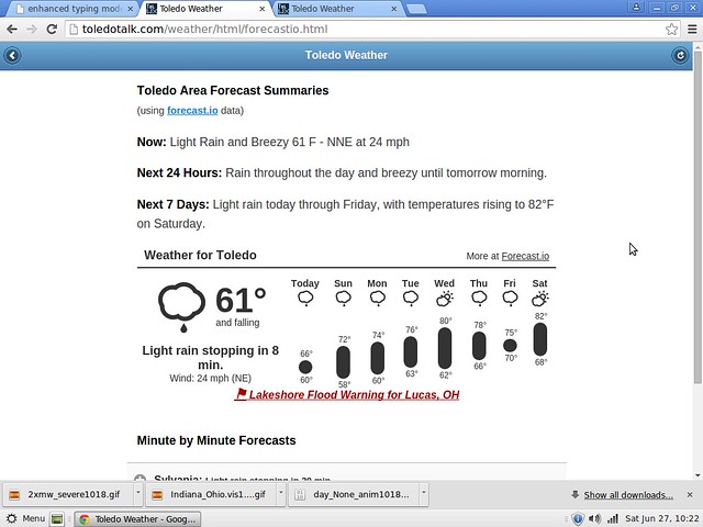
Today: Showers and possibly a thunderstorm. Some of the storms could produce heavy rainfall. High near 63. Breezy, with a north wind around 21 mph. Chance of precipitation is 100%. New rainfall amounts between a half and three quarters of an inch possible.
Tonight: Showers and possibly a thunderstorm, mainly before 2am, then a chance of showers and thunderstorms after 2am. Low around 56. Breezy, with a north wind 22 to 25 mph. Chance of precipitation is 90%. New rainfall amounts between a quarter and half of an inch possible.
Sunday: A chance of showers, mainly before 10am. Cloudy, then gradually becoming mostly sunny, with a high near 76. Breezy, with a northwest wind 17 to 21 mph. Chance of precipitation is 30%. New rainfall amounts of less than a tenth of an inch possible.
Sunday Night: Partly cloudy, with a low around 57. Southwest wind 6 to 9 mph.
Monday: A chance of showers and thunderstorms, then showers likely and possibly a thunderstorm after noon. Mostly cloudy, with a high near 72. South wind 6 to 9 mph. Chance of precipitation is 60%. New rainfall amounts between a tenth and quarter of an inch, except higher amounts possible in thunderstorms.
Monday Night: Showers likely and possibly a thunderstorm. Mostly cloudy, with a low around 61. Chance of precipitation is 70%. New rainfall amounts between a tenth and quarter of an inch, except higher amounts possible in thunderstorms.
Tuesday: A chance of showers and thunderstorms. Mostly cloudy, with a high near 75. Chance of precipitation is 40%.
Tuesday Night: A chance of showers and thunderstorms. Mostly cloudy, with a low around 60. Chance of precipitation is 30%.
Wednesday: Partly sunny, with a high near 76.
Wednesday Night: Mostly cloudy, with a low around 59.
Thursday: Mostly sunny, with a high near 75.
Thursday Night: Partly cloudy, with a low around 58.
Friday: A chance of showers and thunderstorms. Mostly sunny, with a high near 80. Chance of precipitation is 30%.
fxus61 kcle 271158
afdcle
area forecast discussion
national weather service cleveland oh
758 am edt sat jun 27 2015
synopsis...
an unseasonably strong low pressure system will occlude over north
central ohio bringing areas of heavy rain today. the low makes
slow eastward progress into sunday before finally pulling away to
the east coast. a ridge will build over the ohio valley sunday
night followed by the next low pressure system moving through the
central great lakes on monday night.
&&
near term /until 6 pm this evening/...
dry-slot is starting to move into our southwestern counties this
morning. this may signal the end of the steady rain for some areas
but expect bands of showers to continue to develop so will leave
the flood watch in tact...especially since some of these areas
have had 1-1.50 inches of rain already. showers today could
easily bring another half inch of rain. the first river flood
warning has been issued for eagle creek near findlay and more will
follow as water makes its way into the river system.
previous discussion...flood watch remains in effect until 4 am
sunday as rain associated with an unseasonably strong low pressure
system slowly moves through the region. a coastal flood warning
has also been issued for lucas/ottawa/erie counties due to the
long duration of gale force ne winds on lake erie.
low pressure will track to north central ohio by 18z with the
system going through the occlusion process this afternoon. 00z gfs
remains a fast outlier with the eastward progression of the
low...while the nam/sref/rap still show the low over north central
ohio by 00z...with the gem/ecmwf in the middle. the deepening
upper level trough to the west with strong divergence aloft over
se michigan favor the westward position of the low. stratiform
rain on the north flank of the system will remain across nw ohio
for much of the day. meanwhile more intense rainfall with
increasing thunderstorms will start to fill in across the warm
and quickly move across northeast ohio ahead of the mid- level
dry slot that will extend all the way to erie pa by mid afternoon.
breaks in the precipitation will follow behind the dry slot but
will not rule out some additional development along the occluded
front.
thus far the highest rainfall has been across northwest ohio with
around 1.4 inches at fdy through 08z. the steady rain has actually
lifted north of findlay now. rainfall has been slow to arrive in
northeast ohio/nw pa but is expected to fill in and strengthen
through the morning. qpf amounts will range from around an inch and
a half to two and a half inches or locally higher. given the wet
antecedent conditions...the threat for flooding will continue into
tonight. the storm prediction center has also brought the slight
riske for severe storms into the ne ohio...including the akron and
youngstown areas. a lesser threat of severe weather extends to the
north and west. instability may be a limiting factor for severe
weather but forcing ahead of the dry slot will give storms a boost.
shear is plentiful and an isolated tornado will even be possible as
the warm front lifts north into the area and then occludes.
rivers will rise from the recent rainfall and numerous rivers are
forecast to go into flood. the faster responding rivers such as
eagle creek at findlay/independence/eagle creek phalanx station will
be some of the first.
northeast winds of 20 to 30 mph with higher gusts are expected in nw
ohio downwind of lake erie. persistent channelling down the long
fetch of the lake will lead to rising water levels. water levels are
expected to rise at least 3 feet from recent levels by noon...on
top of already high lake levels. a coastal flood warning has been
issued for lucas/ottawa/and erie counties through 10pm. saturated
soils in this area could also contribute to trees being
toppled...even with the sub-advisory level winds.
&&
short term /6 pm this evening through tuesday night/...
a swath of rain associated with the mid-level deformation and
frontogenesis on the back side of the low will linger across extreme
nw ohio through the evening before starting to decrease and pull
east overnight. additional rainfall tonight could be as much as a
half inch across north central ohio. although rain will start to
taper off in many areas overnight...run-off will continue and new
flooding may still develop.
sunday night will be the dry period before another low pressure
system drops into the western great lakes through the northwest
flow. rain will spread east across the area again on monday
afternoon and continue monday night. rainfall will generally be a
half inch or less with this system.
&&
long term /wednesday through friday/...
trough ridge couplets continue to be the story in the extended
forecast. wed morning a trough will be exiting the region with
residual showers and thunderstorms. by thu a shallow shortwave
ridge aloft will facilitate sfc high pressure...keeping pops low
into the first half of friday. by friday night the ridge will be
pushing of the new england coast and another shortwave will be
diving across the midsection of the country. this wave will become
increasingly amplified as it slowly propogates east through
sunday. showers and storms will be highlighted during this period
as the trough axis approaches. as is typically the case...the
models begin to diverge by day 7. the day 6 and 7 forecast is a
compromise between the gfs and ec.
&&
aviation /12z saturday through wednesday/...
all terminals are raining with the exception of keri. cigs have
dropped to mostly ifr or lower across most of northern ohio with the
rain. pockets of lifr cigs now stretch from kfdy...kmfd...and kcak.
not expecting the cigs to improve much throughout the day. in
fact...guidance hints at lifr cigs becoming more widespread. not
ready to jump on this quite yet but hint at the possibility in the
tafs with mention of sct decks less than 1k feet. the heaviest rain
showers are now mostly on the northern and eastern sides of the low
that is now centered across west-central ohio. expecting the rain to
fill back in some around the low as it deepens. there will certainly
be lulls in the shower activity throughout the afternoon...espcially
from kmfd east. timing these breaks beyond the first six hours
will be a challenge...at least initially. this is also where
convection is most likely to get going this afternoon as well. the
wind should continue to pick up through the day and gust to 30
knots or more at times. tonight the wind will diminish some and
become less gusty.
outlook...widespread non vfr expected saturday evening through
sunday in widespread rain. non vfr expected again monday and
monday night and wednesday.
&&
marine...
it will not be a good weekend for boating on lake erie. waves will
build to 9 to 12 feet on the open lake as a surface low bottoms
out near the southern shore today. strong east to northeast flow
will develop today in response to the low...becoming gale force by
afternoon. lakeshore flooding is a real concern given the current
water levels/trends on the lake. a lakeshore flood warning has
been issued for lucas/ottawa/erie counties. speeds should diminish
after midnight allowing water levels to recover. westerly flow
will develop on sunday.
a ridge will cross the lake on monday briefly changing the flow
to southerly. another low will cross the lake monday night into
tuesday with winds again becoming westerly. will likely need small
craft headlines behind this system.
&&
cle watches/warnings/advisories...
oh...beach hazards statement through sunday morning for ohz003-007-
009>012-089.
flood watch through late tonight for ohz003-006>014-017>023-
027>033-036>038-047-089.
lakeshore flood warning until 10 pm edt this evening for
ohz003-007-009.
pa...beach hazards statement through sunday morning for paz001.
flood watch through late tonight for paz001>003.
marine...gale warning until 3 am edt sunday for lez142>146-162>166.
gale warning from 11 am this morning to 3 am edt sunday for
lez147>149-167>169.
&&
$$
synopsis...kec
near term...kec
short term...kec
long term...mayers
aviation...mayers
marine...mayers
fzus51 kcle 270809
nshcle
nearshore marine forecast
national weather service cleveland oh
409 am edt sat jun 27 2015
for waters within five nautical miles of shore on lake erie
lez142>146-271415-
maumee bay to reno beach oh-reno beach to the islands oh-
the islands to vermilion oh-vermilion to avon point oh-
avon point to willowick oh-
409 am edt sat jun 27 2015
..gale warning in effect from 8 am edt this morning through late
tonight...
today...northeast winds to 30 knots increasing to gales to
35 knots this afternoon. showers with isolated thunderstorms.
waves 4 to 6 feet building to 6 to 9 feet.
tonight...northeast gales to 35 knots becoming north to 30 knots
overnight. rain showers. waves 6 to 9 feet subsiding to 5 to
8 feet.
sunday...north winds to 30 knots becoming northwest 15 to
25 knots. rain showers likely in the morning...then a chance of
rain showers in the afternoon. waves 5 to 7 feet subsiding to
2 to 4 feet.
sunday night...west winds 10 knots or less becoming southwest.
mostly cloudy in the evening...then becoming partly cloudy. waves
1 to 3 feet.
winds and waves higher in and near thunderstorms.
see lake erie open lakes forecast for monday through wednesday.
the water temperature off toledo is 71 degrees...off cleveland 68
degrees and off erie 69 degrees.
$$
lez147>149-271415-
willowick to geneva-on-the lake oh-geneva-on-the-
lake to conneaut oh-conneaut oh to ripley ny-
409 am edt sat jun 27 2015
..gale warning in effect from 11 am edt this morning through
late tonight...
today...east winds 15 to 25 knots increasing to gales to
35 knots this afternoon. showers with isolated thunderstorms.
waves 3 to 5 feet building to 6 to 9 feet.
tonight...east winds to 30 knots becoming northeast 15 to
25 knots. rain showers. waves 5 to 8 feet.
sunday...northeast winds 15 to 25 knots becoming northwest. rain
showers in the morning...then rain showers likely in the
afternoon. waves 5 to 8 feet subsiding to 3 to 5 feet.
sunday night...northwest winds 5 to 15 knots becoming west.
mostly cloudy. waves 2 to 4 feet subsiding to 1 to 3 feet.
winds and waves higher in and near thunderstorms.
see lake erie open lakes forecast for monday through wednesday.
the water temperature off toledo is 71 degrees...off cleveland 68
degrees and off erie 69 degrees.
By 10:00 p.m. yesterday, Fri, Jun 26, 2015, only some drizzle or sprinkles had fallen over West Toledo because the public sidewalk in front of our home was still dry because of the maple trees. Some light rain may have fallen before Midnight. At most, I would say 0.05 inches of #rainfall had occurred before on Jun 26.
I got woken up around 3:00 a.m. because of the mod-hvy rainfall. I had both of upstairs windows raised. The north window contained a fan set to low. I closed the north window, and I left the west window open because of the gusty north-northeast winds. I probably should have closed the west window, but I guess that I didn't mind the noise from the wind and rain battering the fully-leafed hardwood trees. Loud water spray sound.
At 10:15 a.m. on Sat, Jun 27, 2015, I emptied my rain gauge. It measured 1.40 inches of rainfall. At least 1.35 inches fell today.
At 10:30 a.m., the light rain continued to fall. Our rain may end later this morning or become scattered showers as a dry slot moves in from the south. We may get the back side of the low and more rain later today.
This is amazing weather for June 27. I could see this happening in April or early May and of course in the mid to late fall.
Toledo 7-day forecast
Last Update: Jun 27, 2015 10:07 am
Today: Rain and possibly a thunderstorm. Some of the storms could produce heavy rainfall. High near 62. Breezy, with a north wind around 22 mph. Chance of precipitation is 80%. New rainfall amounts between a half and three quarters of an inch possible.
Tonight: Showers and possibly a thunderstorm before 11pm, then scattered showers. Some of the storms could produce heavy rainfall. Low around 56. Breezy, with a north wind 22 to 24 mph. Chance of precipitation is 80%. New rainfall amounts between a quarter and half of an inch possible.
Sunday: A chance of showers, mainly before 10am. Cloudy, then gradually becoming mostly sunny, with a high near 76. Breezy, with a northwest wind 17 to 21 mph. Chance of precipitation is 30%. New precipitation amounts of less than a tenth of an inch possible.
Sunday Night: Partly cloudy, with a low around 57. Southwest wind 6 to 9 mph.
Monday: A chance of showers and thunderstorms, then showers likely and possibly a thunderstorm after noon. Mostly cloudy, with a high near 72. South wind 6 to 9 mph. Chance of precipitation is 60%. New rainfall amounts between a tenth and quarter of an inch, except higher amounts possible in thunderstorms.
Monday Night: Showers likely and possibly a thunderstorm. Mostly cloudy, with a low around 61. Chance of precipitation is 70%. New rainfall amounts between a tenth and quarter of an inch, except higher amounts possible in thunderstorms.
Tuesday: A chance of showers and thunderstorms. Mostly cloudy, with a high near 75. Chance of precipitation is 40%.
Tuesday Night: A chance of showers and thunderstorms. Mostly cloudy, with a low around 60. Chance of precipitation is 30%.
Wednesday: Partly sunny, with a high near 76.
Wednesday Night: Mostly cloudy, with a low around 59.
Thursday: Mostly sunny, with a high near 75.
Thursday Night: Partly cloudy, with a low around 58.
Friday: A chance of showers and thunderstorms. Mostly sunny, with a high near 80. Chance of precipitation is 30%.
lakeshore hazard message
national weather service cleveland oh
1006 am edt sat jun 27 2015
ohz003-007-009-272215-
/o.con.kcle.ls.w.0001.000000t0000z-150628t0200z/
/o.con.kcle.bh.s.0004.000000t0000z-150628t1300z/
lucas-ottawa-erie oh-
1006 am edt sat jun 27 2015
...lakeshore flood warning remains in effect until 10 pm edt this
evening...
...beach hazards statement remains in effect through sunday
morning...
- lake shore flooding...strong northeast winds to 35 knots will
develop saturday and may result in flooding along the
lakeshore.
- hazards...coastal flooding and dangerous swimming conditions.
- timing...dangerous swimming conditions will occur through sunday
morning. the coastal flooding threat will end at 10pm saturday
evening.
- location...the lakeshore from from lucas county to erie county
ohio
- impacts...large waves will cause rip currents to develop.
rising water levels due to driving winds may result flooding
along the lakeshore.
precautionary/preparedness actions...
a lakeshore flood warning means lakeshore flooding is
occurring... is imminent... or is expected to occur within the
next 12 hours. people in the warning area should take immediate
action to protect life and property. listen to local
radio...television... or noaa weather radio for further
information.
swimming risk exists today. the combination of wind and or waves
will make for potentially dangerous conditions for swimmers
including the risk of rip currents. follow the instruction of
local authorities or stay out of the water.
special weather statement
national weather service cleveland oh
115 pm edt sat jun 27 2015
ohz003-006>009-272015-
lucas-wood-ottawa-sandusky-erie oh-
including the cities of...toledo...bowling green...port clinton...
fremont...sandusky
115 pm edt sat jun 27 2015
...gusty winds will affect lucas...wood...ottawa...sandusky...and
erie counties through this afternoon...
gusty northeast winds will continue this afternoon. while gusts to
40 mph will be most common...gusts to 50 mph will be possible.
there have been a few reports of trees and limbs down in the
area due to the strong winds.
$$
oudeman
flood watch
flood watch
national weather service cleveland oh
1145 am edt sat jun 27 2015
...flood threat continues into tonight...
low pressure will remain over northern ohio today. widespread
moderate to heavy rain will give way to scattered showers for this
afternoon. a few thunderstorms will also be possible across
eastern ohio. these thunderstorms will potentially be accompanied
by high rainfall rates. steady rain is expected to return again to
northwest ohio. the area will receive between one and a half and
two and a half inches of rain through tonight...with locally
higher amounts possible. this amount of rainfall will be excessive
and lead to flooding in some areas through tonight...especially
those that have received high amounts of rain over the last week.
ohz003-006>014-017>023-027>033-036>038-047-089-paz001>003-280000-
/o.con.kcle.fa.a.0003.000000t0000z-150628t0800z/
/00000.0.er.000000t0000z.000000t0000z.000000t0000z.oo/
lucas-wood-ottawa-sandusky-erie oh-lorain-cuyahoga-lake-geauga-
ashtabula inland-hancock-seneca-huron-medina-summit-portage-
trumbull-wyandot-crawford-richland-ashland-wayne-stark-mahoning-
marion-morrow-holmes-knox-ashtabula lakeshore-northern erie-
southern erie-crawford pa-
including the cities of...toledo...bowling green...port clinton...
fremont...sandusky...lorain...cleveland...mentor...chardon...
jefferson...findlay...tiffin...norwalk...medina...akron...
ravenna...warren...upper sandusky...carey...bucyrus...mansfield...
ashland...wooster...canton...youngstown...marion...mount gilead...
millersburg...mount vernon...ashtabula...erie...edinboro...
meadville
1145 am edt sat jun 27 2015
...flood watch remains in effect through late tonight...
the flood watch continues for
- portions of ohio and northwest pennsylvania...including the
following areas...in ohio...ashland...ashtabula inland...
ashtabula lakeshore...crawford...cuyahoga...erie oh...geauga...
hancock...holmes...huron...knox...lake...lorain...lucas...
mahoning...marion...medina...morrow...ottawa...portage...
richland...sandusky...seneca...stark...summit...trumbull...
wayne...wood and wyandot. in northwest pennsylvania...crawford
pa...northern erie and southern erie.
- through late tonight
- a slow moving low pressure system will remain across the area
today then slowly exit to the east on sunday. steady rainfall is
expected in northwest ohio with periods of showers and
thunderstorms in northeast ohio. widespread rainfall of 1.5 to
2.5 inches of rain will fall by late tonight. locally higher
amounts are possible. given the recent wet
conditions...flooding will likely develop in some areas.
- flooding...especially in urban areas...can occur very
quickly...primarily at underpasses and poor drainage areas.
rises on area creeks and streams will occur and may be running
at high capacity from the heavy rainfall.
precautionary/preparedness actions...
a flood watch means there is a potential for flooding based on
current forecasts. you should monitor later forecasts and be
alert for possible flood warnings. those living in areas prone to
flooding should be prepared to take action should flooding
develop. stay tuned to weather radio for further details or
updates
&&
$$
beach hazards statement
lakeshore hazard message
national weather service cleveland oh
1006 am edt sat jun 27 2015
ohz003-007-009-272215-
/o.con.kcle.ls.w.0001.000000t0000z-150628t0200z/
/o.con.kcle.bh.s.0004.000000t0000z-150628t1300z/
lucas-ottawa-erie oh-
1006 am edt sat jun 27 2015
...lakeshore flood warning remains in effect until 10 pm edt this
evening...
...beach hazards statement remains in effect through sunday
morning...
- lake shore flooding...strong northeast winds to 35 knots will
develop saturday and may result in flooding along the
lakeshore.
- hazards...coastal flooding and dangerous swimming conditions.
- timing...dangerous swimming conditions will occur through sunday
morning. the coastal flooding threat will end at 10pm saturday
evening.
- location...the lakeshore from from lucas county to erie county
ohio
- impacts...large waves will cause rip currents to develop.
rising water levels due to driving winds may result flooding
along the lakeshore.
precautionary/preparedness actions...
a lakeshore flood warning means lakeshore flooding is
occurring... is imminent... or is expected to occur within the
next 12 hours. people in the warning area should take immediate
action to protect life and property. listen to local
radio...television... or noaa weather radio for further
information.
swimming risk exists today. the combination of wind and or waves
will make for potentially dangerous conditions for swimmers
including the risk of rip currents. follow the instruction of
local authorities or stay out of the water.
&&
$$
lakeshore flood warning
lakeshore hazard message
national weather service cleveland oh
1006 am edt sat jun 27 2015
ohz003-007-009-272215-
/o.con.kcle.ls.w.0001.000000t0000z-150628t0200z/
/o.con.kcle.bh.s.0004.000000t0000z-150628t1300z/
lucas-ottawa-erie oh-
1006 am edt sat jun 27 2015
...lakeshore flood warning remains in effect until 10 pm edt this
evening...
...beach hazards statement remains in effect through sunday
morning...
- lake shore flooding...strong northeast winds to 35 knots will
develop saturday and may result in flooding along the
lakeshore.
- hazards...coastal flooding and dangerous swimming conditions.
- timing...dangerous swimming conditions will occur through sunday
morning. the coastal flooding threat will end at 10pm saturday
evening.
- location...the lakeshore from from lucas county to erie county
ohio
- impacts...large waves will cause rip currents to develop.
rising water levels due to driving winds may result flooding
along the lakeshore.
precautionary/preparedness actions...
a lakeshore flood warning means lakeshore flooding is
occurring... is imminent... or is expected to occur within the
next 12 hours. people in the warning area should take immediate
action to protect life and property. listen to local
radio...television... or noaa weather radio for further
information.
swimming risk exists today. the combination of wind and or waves
will make for potentially dangerous conditions for swimmers
including the risk of rip currents. follow the instruction of
local authorities or stay out of the water.
&&
$$
hazardous weather outlook
hazardous weather outlook
national weather service cleveland oh
508 am edt sat jun 27 2015
ohz003-007-009-280915-
lucas-ottawa-erie oh-
508 am edt sat jun 27 2015
...flood watch in effect through late tonight...
...lakeshore flood warning in effect until 10 pm edt this evening...
...beach hazards statement in effect from this evening through
sunday morning...
this hazardous weather outlook is for north central ohio and
northwest ohio.
.day one...today and tonight.
please listen to noaa weather radio or go to weather.gov on the
internet for more information about the following hazards.
flood watch.
lakeshore flood warning.
beach hazards statement.
.days two through seven...sunday through friday.
please listen to noaa weather radio or go to weather.gov on the
internet for more information about the following hazards.
beach hazards statement.
.spotter information statement...
spotter activation may be needed. reports of rainfall or flooding
are appreciated.
$$
flood advisory
national weather service cleveland oh
201 pm edt sat jun 27 2015
ohc095-123-143-173-280400-
/o.new.kcle.fa.y.0035.150627t1801z-150628t0400z/
/00000.n.er.000000t0000z.000000t0000z.000000t0000z.oo/
wood oh-sandusky oh-lucas oh-ottawa oh-
201 pm edt sat jun 27 2015
the national weather service in cleveland has issued a
- flood advisory for...
wood county in northwestern ohio...
sandusky county in northwestern ohio...
lucas county in northwestern ohio...
ottawa county in northwestern ohio...
- until midnight edt sunday
- at 158 pm edt...doppler radar indicated heavy rainfall from
showers that have been occurring since last night. rainfall
amounts of 1 to 2 inches have been common. the continued showers
have caused low lying areas to flood.
- some locations that will experience flooding include...
bowling green...fremont...fostoria...port clinton...perrysburg...
oregon...sylvania...bellevue...clyde...rossford...waterville...
northwood...whitehouse...north baltimore...oak harbor...
gibsonburg...genoa...woodville...holland and weston.
precautionary/preparedness actions...
most flood deaths occur in automobiles. never drive your vehicle into
areas where the water covers the roadway. flood waters are usually
deeper than they appear. just one foot of flowing water is powerful
enough to sweep vehicles off the road. when encountering flooded
roads make the smart choice...turn around...dont drown.
excessive runoff from heavy rainfall will cause ponding of water in
urban areas...highways...streets and underpasses as well as other
poor drainage areas and low lying spots. do not attempt to travel
across flooded roads. find alternate routes.
&&
lat...lon 4172 8387 4173 8346 4173 8345 4172 8347
4169 8344 4161 8310 4151 8299 4152 8289
4159 8284 4153 8282 4151 8276 4150 8277
4149 8296 4145 8304 4142 8294 4144 8285
4125 8284 4125 8341 4117 8342 4117 8388
$$
mullen
special weather statement
special weather statement
national weather service cleveland oh
115 pm edt sat jun 27 2015
ohz003-006>009-272015-
lucas-wood-ottawa-sandusky-erie oh-
including the cities of...toledo...bowling green...port clinton...
fremont...sandusky
115 pm edt sat jun 27 2015
...gusty winds will affect lucas...wood...ottawa...sandusky...and
erie counties through this afternoon...
gusty northeast winds will continue this afternoon. while gusts to
40 mph will be most common...gusts to 50 mph will be possible.
there have been a few reports of trees and limbs down in the
area due to the strong winds.
$$
oudeman
flood watch
flood watch
national weather service cleveland oh
1145 am edt sat jun 27 2015
...flood threat continues into tonight...
low pressure will remain over northern ohio today. widespread
moderate to heavy rain will give way to scattered showers for this
afternoon. a few thunderstorms will also be possible across
eastern ohio. these thunderstorms will potentially be accompanied
by high rainfall rates. steady rain is expected to return again to
northwest ohio. the area will receive between one and a half and
two and a half inches of rain through tonight...with locally
higher amounts possible. this amount of rainfall will be excessive
and lead to flooding in some areas through tonight...especially
those that have received high amounts of rain over the last week.
ohz003-006>014-017>023-027>033-036>038-047-089-paz001>003-280000-
/o.con.kcle.fa.a.0003.000000t0000z-150628t0800z/
/00000.0.er.000000t0000z.000000t0000z.000000t0000z.oo/
lucas-wood-ottawa-sandusky-erie oh-lorain-cuyahoga-lake-geauga-
ashtabula inland-hancock-seneca-huron-medina-summit-portage-
trumbull-wyandot-crawford-richland-ashland-wayne-stark-mahoning-
marion-morrow-holmes-knox-ashtabula lakeshore-northern erie-
southern erie-crawford pa-
including the cities of...toledo...bowling green...port clinton...
fremont...sandusky...lorain...cleveland...mentor...chardon...
jefferson...findlay...tiffin...norwalk...medina...akron...
ravenna...warren...upper sandusky...carey...bucyrus...mansfield...
ashland...wooster...canton...youngstown...marion...mount gilead...
millersburg...mount vernon...ashtabula...erie...edinboro...
meadville
1145 am edt sat jun 27 2015
...flood watch remains in effect through late tonight...
the flood watch continues for
- portions of ohio and northwest pennsylvania...including the
following areas...in ohio...ashland...ashtabula inland...
ashtabula lakeshore...crawford...cuyahoga...erie oh...geauga...
hancock...holmes...huron...knox...lake...lorain...lucas...
mahoning...marion...medina...morrow...ottawa...portage...
richland...sandusky...seneca...stark...summit...trumbull...
wayne...wood and wyandot. in northwest pennsylvania...crawford
pa...northern erie and southern erie.
- through late tonight
- a slow moving low pressure system will remain across the area
today then slowly exit to the east on sunday. steady rainfall is
expected in northwest ohio with periods of showers and
thunderstorms in northeast ohio. widespread rainfall of 1.5 to
2.5 inches of rain will fall by late tonight. locally higher
amounts are possible. given the recent wet
conditions...flooding will likely develop in some areas.
- flooding...especially in urban areas...can occur very
quickly...primarily at underpasses and poor drainage areas.
rises on area creeks and streams will occur and may be running
at high capacity from the heavy rainfall.
precautionary/preparedness actions...
a flood watch means there is a potential for flooding based on
current forecasts. you should monitor later forecasts and be
alert for possible flood warnings. those living in areas prone to
flooding should be prepared to take action should flooding
develop. stay tuned to weather radio for further details or
updates
&&
$$
beach hazards statement
lakeshore hazard message
national weather service cleveland oh
1006 am edt sat jun 27 2015
ohz003-007-009-272215-
/o.con.kcle.ls.w.0001.000000t0000z-150628t0200z/
/o.con.kcle.bh.s.0004.000000t0000z-150628t1300z/
lucas-ottawa-erie oh-
1006 am edt sat jun 27 2015
...lakeshore flood warning remains in effect until 10 pm edt this
evening...
...beach hazards statement remains in effect through sunday
morning...
- lake shore flooding...strong northeast winds to 35 knots will
develop saturday and may result in flooding along the
lakeshore.
- hazards...coastal flooding and dangerous swimming conditions.
- timing...dangerous swimming conditions will occur through sunday
morning. the coastal flooding threat will end at 10pm saturday
evening.
- location...the lakeshore from from lucas county to erie county
ohio
- impacts...large waves will cause rip currents to develop.
rising water levels due to driving winds may result flooding
along the lakeshore.
precautionary/preparedness actions...
a lakeshore flood warning means lakeshore flooding is
occurring... is imminent... or is expected to occur within the
next 12 hours. people in the warning area should take immediate
action to protect life and property. listen to local
radio...television... or noaa weather radio for further
information.
swimming risk exists today. the combination of wind and or waves
will make for potentially dangerous conditions for swimmers
including the risk of rip currents. follow the instruction of
local authorities or stay out of the water.
&&
$$
lakeshore flood warning
lakeshore hazard message
national weather service cleveland oh
1006 am edt sat jun 27 2015
ohz003-007-009-272215-
/o.con.kcle.ls.w.0001.000000t0000z-150628t0200z/
/o.con.kcle.bh.s.0004.000000t0000z-150628t1300z/
lucas-ottawa-erie oh-
1006 am edt sat jun 27 2015
...lakeshore flood warning remains in effect until 10 pm edt this
evening...
...beach hazards statement remains in effect through sunday
morning...
- lake shore flooding...strong northeast winds to 35 knots will
develop saturday and may result in flooding along the
lakeshore.
- hazards...coastal flooding and dangerous swimming conditions.
- timing...dangerous swimming conditions will occur through sunday
morning. the coastal flooding threat will end at 10pm saturday
evening.
- location...the lakeshore from from lucas county to erie county
ohio
- impacts...large waves will cause rip currents to develop.
rising water levels due to driving winds may result flooding
along the lakeshore.
precautionary/preparedness actions...
a lakeshore flood warning means lakeshore flooding is
occurring... is imminent... or is expected to occur within the
next 12 hours. people in the warning area should take immediate
action to protect life and property. listen to local
radio...television... or noaa weather radio for further
information.
swimming risk exists today. the combination of wind and or waves
will make for potentially dangerous conditions for swimmers
including the risk of rip currents. follow the instruction of
local authorities or stay out of the water.
&&
$$
hazardous weather outlook
hazardous weather outlook
national weather service cleveland oh
508 am edt sat jun 27 2015
ohz003-007-009-280915-
lucas-ottawa-erie oh-
508 am edt sat jun 27 2015
...flood watch in effect through late tonight...
...lakeshore flood warning in effect until 10 pm edt this evening...
...beach hazards statement in effect from this evening through
sunday morning...
this hazardous weather outlook is for north central ohio and
northwest ohio.
.day one...today and tonight.
please listen to noaa weather radio or go to weather.gov on the
internet for more information about the following hazards.
flood watch.
lakeshore flood warning.
beach hazards statement.
.days two through seven...sunday through friday.
please listen to noaa weather radio or go to weather.gov on the
internet for more information about the following hazards.
beach hazards statement.
.spotter information statement...
spotter activation may be needed. reports of rainfall or flooding
are appreciated.
$$
TOL: Jun 27, 2015 2:52 pm
Weather : Heavy Rain Fog/Mist
Temperature : 59 F
Humidity : 96%
Wind Speed : N 18 mph - Gust 24 mph
Barometer : 29.69 in
Dewpoint: 58 F
Visibility : 1.00 statute miles
Toledo 7-day forecast
Last Update: Jun 27, 2015 10:07 am
Late Afternoon: Rain and possibly a thunderstorm. Some of the storms could produce heavy rainfall. High near 62. Breezy, with a north wind around 23 mph. Chance of precipitation is 90%. New rainfall amounts between a tenth and quarter of an inch, except higher amounts possible in thunderstorms.
Tonight: Showers and possibly a thunderstorm before 11pm, then scattered showers. Some of the storms could produce heavy rainfall. Low around 56. Breezy, with a north wind 22 to 24 mph. Chance of precipitation is 80%. New rainfall amounts between a quarter and half of an inch possible.
Sunday: A chance of showers, mainly before 10am. Cloudy, then gradually becoming mostly sunny, with a high near 76. Breezy, with a northwest wind 17 to 21 mph. Chance of precipitation is 30%. New precipitation amounts of less than a tenth of an inch possible.
Sunday Night: Partly cloudy, with a low around 57. Southwest wind 6 to 9 mph.
Monday: A chance of showers and thunderstorms, then showers likely and possibly a thunderstorm after noon. Mostly cloudy, with a high near 72. South wind 6 to 9 mph. Chance of precipitation is 60%. New rainfall amounts between a tenth and quarter of an inch, except higher amounts possible in thunderstorms.
Monday Night: Showers likely and possibly a thunderstorm. Mostly cloudy, with a low around 61. Chance of precipitation is 70%. New rainfall amounts between a tenth and quarter of an inch, except higher amounts possible in thunderstorms.
Tuesday: A chance of showers and thunderstorms. Mostly cloudy, with a high near 75. Chance of precipitation is 40%.
Tuesday Night: A chance of showers and thunderstorms. Mostly cloudy, with a low around 60. Chance of precipitation is 30%.
Wednesday: Partly sunny, with a high near 76.
Wednesday Night: Mostly cloudy, with a low around 59.
Thursday: Mostly sunny, with a high near 75.
Thursday Night: Partly cloudy, with a low around 58.
Friday: A chance of showers and thunderstorms. Mostly sunny, with a high near 80. Chance of precipitation is 30%.
Friday Night: A chance of showers. Partly cloudy, with a low around 61. Chance of precipitation is 30%.
Independence Day: A chance of showers. Partly sunny, with a high near 76.
xus61 kcle 271754
afdcle
area forecast discussion
national weather service cleveland oh
154 pm edt sat jun 27 2015
synopsis...
an unseasonably strong low pressure system will occlude over north
central ohio bringing areas of heavy rain today. the low makes
slow eastward progress into sunday before finally pulling away to
the east coast. a ridge will build over the ohio valley sunday
night followed by the next low pressure system moving through the
central great lakes on monday night.
&&
near term /until 6 pm this evening/...
no changes to the forecast for the rest of today. still watching
for what convection may be able to get going as warm
front/occluding front lifts north. will keep the flood watch as is
but suspect we may be able to start trimming it closer to the
next forecast package issuance.
low center is currently near upper sandusky and will only slowly
work its way across northern ohio through this evening. steadier
rain is pushing off to the north...staying north and northwest of
the low track. this will keep the steadier rain in nw ohio.
scattered showers/ts across the rest of eastern ohio/nw pa. these
will have heavy rainfall with them.
precip totals so far:
findlay 1.99 inches
toledo 1.22
cleveland 1.38
marion 1.18
lorain 1.99
youngstown 1.37
slight risk for severe has been trimmed back some...main threat
would be wind. a lesser threat of severe weather extends to the
north and west. instability may be a limiting factor for severe
weather but forcing ahead of the dry slot will give storms a
boost. shear is plentiful and an isolated tornado will even be
possible as the warm front lifts north into the area and then
occludes.
low 70s will push up across eastern ohio with the advancement of
the warm sector.
rivers will rise from the recent rainfall and numerous rivers are
forecast to go into flood. the faster responding rivers such as
eagle creek at findlay/independence/eagle creek phalanx station will
be some of the first.
northeast winds of 20 to 30 mph with higher gusts are expected in nw
ohio downwind of lake erie. persistent channeling down the long
fetch of the lake will lead to rising water levels. water levels
are expected to rise at least 3 feet from recent levels by
noon...on top of already high lake levels. a coastal flood warning
has been issued for lucas/ottawa/and erie counties through 10pm.
saturated soils in this area could also contribute to trees being
toppled...even with the sub-advisory level winds.
&&
short term /6 pm this evening through tuesday night/...
a swath of rain associated with the mid-level deformation and
frontogenesis on the back side of the low will linger across extreme
nw ohio through the evening before starting to decrease and pull
east overnight. additional rainfall tonight could be as much as a
half inch across north central ohio. although rain will start to
taper off in many areas overnight...run-off will continue and new
flooding may still develop.
sunday night will be the dry period before another low pressure
system drops into the western great lakes through the northwest
flow. rain will spread east across the area again on monday
afternoon and continue monday night. rainfall will generally be a
half inch or less with this system.
&&
long term /wednesday through friday/...
trough ridge couplets continue to be the story in the extended
forecast. wed morning a trough will be exiting the region with
residual showers and thunderstorms. by thu a shallow shortwave
ridge aloft will facilitate sfc high pressure...keeping pops low
into the first half of friday. by friday night the ridge will be
pushing of the new england coast and another shortwave will be
diving across the midsection of the country. this wave will become
increasingly amplified as it slowly propagates east through
sunday. showers and storms will be highlighted during this period
as the trough axis approaches. as is typically the case...the
models begin to diverge by day 7. the day 6 and 7 forecast is a
compromise between the gfs and ec.
&&
aviation /18z saturday through thursday/...
surface low just to the southwest of kcle making for a difficult
taf forecast. variable ceilings generally in the mvfr/ifr levels.
much of the ifr occurring in the showers and thunderstorms. winds
have been the greatest challenge with the models inconsistent on
the path of the surface low. central and eastern areas will
generally have a southerly wind with locations closer to the lake
having northeast to north winds. the strongest winds will be west
of the surface low...mainly for the ktol area.
showers will linger across the region into sunday morning with
most locations ifr into mid morning.
outlook...non vfr expected sunday in scattered showers. non vfr
expected again monday/monday night and wednesday.
&&
marine...
low pressure has not deepened as far as earlier expected. so far
winds have only touched gales across the western basin and believe
it is going to be difficult to exceed 30 knots elsewhere. will
continue to monitor the situation and make changes to the gales
warning if needed. water levels across the western basin have
increased but since winds have been a bit more northerly the
volume of water pushed into the western basin has been minimal. if
winds do not increase as much as earlier thinking then water
levels in the western basin will not be elevated. will monitor
this through the afternoon.
previous discussion...
it will not be a good weekend for boating on lake erie. waves
will build to 9 to 12 feet on the open lake as a surface low
bottoms out near the southern shore today. strong east to
northeast flow will develop today in response to the
low...becoming gale force by afternoon. lakeshore flooding is a
real concern given the current water levels/trends on the lake. a
lakeshore flood warning has been issued for lucas/ottawa/erie
counties. speeds should diminish after midnight allowing water
levels to recover. westerly flow will develop on sunday.
a ridge will cross the lake on monday briefly changing the flow
to southerly. another low will cross the lake monday night into
tuesday with winds again becoming westerly. will likely need small
craft headlines behind this system.
&&
cle watches/warnings/advisories...
oh...beach hazards statement through sunday morning for ohz003-007-
009>012-089.
flood watch through late tonight for ohz003-006>014-017>023-
027>033-036>038-047-089.
lakeshore flood warning until 10 pm edt this evening for
ohz003-007-009.
pa...beach hazards statement through sunday morning for paz001.
flood watch through late tonight for paz001>003.
marine...gale warning until 3 am edt sunday for lez142>149-162>169.
&&
$$
synopsis...kec
near term...kec/oudeman
short term...kec
long term...mayers
aviation...mullen
marine...mayers/mullen
fzus51 kcle 271404
nshcle
nearshore marine forecast
national weather service cleveland oh
1004 am edt sat jun 27 2015
for waters within five nautical miles of shore on lake erie
lez142>146-272030-
maumee bay to reno beach oh-reno beach to the islands oh-
the islands to vermilion oh-vermilion to avon point oh-
avon point to willowick oh-
1004 am edt sat jun 27 2015
..gale warning in effect through late tonight...
this afternoon...east gales to 35 knots. rain with isolated
thunderstorms. waves 7 to 10 feet subsiding to 5 to 7 feet.
tonight...east winds to 30 knots becoming northeast. rain. waves
5 to 7 feet subsiding to 3 to 5 feet.
sunday...north winds to 30 knots becoming northwest 15 to
25 knots. rain showers likely in the morning...then a chance of
rain showers in the afternoon. waves 5 to 7 feet subsiding to
2 to 4 feet.
sunday night...west winds 10 knots or less becoming southwest.
mostly cloudy in the evening...then becoming partly cloudy. waves
1 to 3 feet.
winds and waves higher in and near thunderstorms.
see lake erie open lakes forecast for monday through wednesday.
the water temperature off toledo is 70 degrees...off cleveland 68
degrees and off erie 69 degrees.
$$
lez147>149-272030-
willowick to geneva-on-the lake oh-geneva-on-the-
lake to conneaut oh-conneaut oh to ripley ny-
1004 am edt sat jun 27 2015
..gale warning in effect through late tonight...
this afternoon...east winds 15 to 25 knots increasing to 35 knot
gales late. rain with isolated thunderstorms. waves 6 to 9 feet
subsiding to 5 to 7 feet.
tonight...east gales to 35 knots diminishing to 10 to 20 knots.
rain in the evening...then rain likely overnight. waves 5 to 7
feet subsiding to 2 to 4 feet.
sunday...northeast winds 15 to 25 knots becoming northwest. rain
showers in the morning...then rain showers likely in the
afternoon. waves 5 to 8 feet subsiding to 3 to 5 feet.
sunday night...northwest winds 5 to 15 knots becoming west.
mostly cloudy. waves 2 to 4 feet subsiding to 1 to 3 feet.
winds and waves higher in and near thunderstorms.
see lake erie open lakes forecast for monday through wednesday.
the water temperature off toledo is 70 degrees...off cleveland 68
degrees and off erie 69 degrees.
flood warning
national weather service cleveland oh
342 pm edt sat jun 27 2015
ohc095-173-281945-
/o.new.kcle.fa.w.0013.150627t1942z-150628t1945z/
/00000.0.er.000000t0000z.000000t0000z.000000t0000z.oo/
wood oh-lucas oh-
342 pm edt sat jun 27 2015
the national weather service in cleveland has issued a
- flood warning for urban areas and small streams in...
wood county in northwestern ohio...
lucas county in northwestern ohio...
- until 345 pm edt sunday
- at 339 pm edt...doppler radar indicated heavy rain that will cause
flooding. two to three inches of rain has fallen over much of the
area since yesterday evening. another inch of rain is likely for
many areas through tonight.
- some locations that will experience flooding include...
bowling green...fostoria...perrysburg...oregon...sylvania...
rossford...waterville...northwood...whitehouse...north baltimore...
holland...weston...maumee...ottawa hills...walbridge...
pemberville...millbury...haskins...luckey and bradner.
precautionary/preparedness actions...
excessive runoff from heavy rainfall will cause flooding of small
creeks and streams...highways and underpasses in urban areas.
additionally...country roads and farmlands along the banks of
creeks...streams and other low lying areas are subject to flooding.
&&
lat...lon 4172 8387 4173 8346 4173 8345 4172 8347
4169 8343 4169 8335 4171 8334 4164 8323
4163 8318 4174 8311 4162 8318 4162 8342
4117 8342 4117 8388 4118 8388
From JR's : articles
11338 words - 77260 chars
- 62 min read
created on
updated on
- #
source
- versions
- backlinks
Related articles
June 2015 Rainfall - Jul 02, 2015
Toledo weather sat sep 5 2015 - Sep 05, 2015
Tt comment oct 28, 2015 - b - Oct 28, 2015
Severe weather threat for Sun, Nov 17, 2013 - Nov 18, 2013
Nov 17, 2013 Toledo area weather notes - Mar 03, 2014
more >>