Toledo Weather - Wed, Jul 20, 2016
hazardous weather outlook
national weather service cleveland oh
338 pm edt wed jul 20 2016
hot humid conditions will arrive friday and continue into the weekend. afternoon highs friday will reach the low to mid 90s pushing heat index values to between 100 and 104 degrees.saturday and sunday, heat index values are expected to top out between 95 and 100 saturday and sunday.
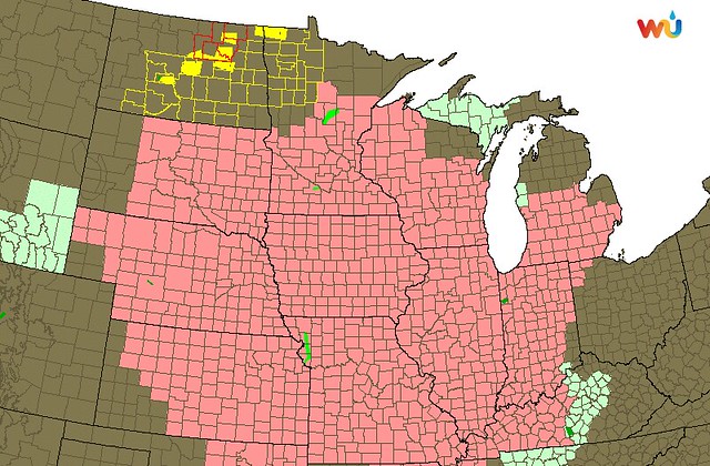
Heat Advisories and Excessive Heat Warnings are up for the Central U.S.
The Detroit/Pontiac and N. Indiana weather offices issued Heat Advisories for their coverage areas.
For Monroe County:
Heat advisory in effect from 1 PM Thursday to 10 PM EDT
Fridaytemperatures in the 90s and high humidity will cause heat indices to approach 100 degrees on Thursday and exceed 100 degrees on Friday.
Very high humidity will limit the potential for overnight relief.
Impacts...
- those spending time outdoors will be suceptible to dehydration and heat-related illness.
- Elderly persons, outdoor pets, and those without air conditioning will also be subject to heat stress.
Fulton County:
Heat advisory remains in effect from 2 PM Thursday to 8 PM EDT
Fridaytemperatures... highs in the upper 80s to mid 90s Thursday and Friday. Lows in the 70s will provide little relief from the humidity Thursday night.
Maximum afternoon heat index values... near 100 degrees Thursday and 100 to 105 degrees on Friday.
Dangerous heat and humidity may continue into Saturday and Sunday.
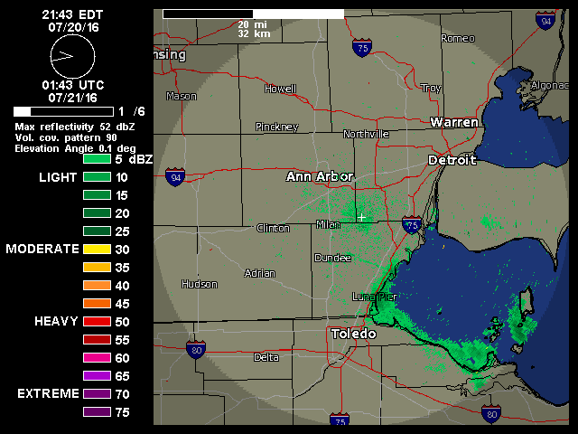
Mayflies still emerging. Wed, Jul 20, 2016.
flus41 kcle 201938
hwocle
hazardous weather outlook
national weather service cleveland oh
338 pm edt wed jul 20 2016
ohz003-006>011-017>021-027>032-036>038-047-211945-
lucas-wood-ottawa-sandusky-erie-lorain-cuyahoga-hancock-seneca-huron-
medina-summit-wyandot-crawford-richland-ashland-wayne-stark-marion-
morrow-holmes-knox-
338 pm edt wed jul 20 2016
this hazardous weather outlook is for north central
ohio...northeast ohio and northwest ohio.
day one...this afternoon and tonight.
no hazardous weather is expected at this time.
days two through seven...thursday through tuesday.
hot humid conditions will arrive friday and continue into the
weekend. afternoon highs friday will reach the low to mid 90s
pushing heat index values to between 100 and 104 degrees. saturday
and sunday, heat index values are expected to top out between 95
and 100 saturday and sunday this will make it feel very
uncomfortable and increase risk for heat stroke.
also, strong to severe thunderstorms may develop over southern
ontario thursday night into early friday morning. if they can
develop, the potential for strong damaging winds will exist.
spotter information statement...
spotter activation is not expected at this time.
$$
ohz012>014-022-023-033-089-paz001>003-211945-
lake-geauga-ashtabula inland-portage-trumbull-mahoning-
ashtabula lakeshore-northern erie-southern erie-crawford-
338 pm edt wed jul 20 2016
this hazardous weather outlook is for northeast ohio and northwest
pennsylvania.
day one...this afternoon and tonight.
no hazardous weather is expected at this time.
days two through seven...thursday through tuesday.
hot humid conditions will arrive friday and continue into the
weekend. afternoon highs friday will reach near 90 pushing heat
index values to between 95 and 100 degrees. saturday and sunday,
heat index values are expected to top out between 90 and 95
saturday and sunday this will make it feel very uncomfortable and
increase risk for heat stroke.
also, strong to severe thunderstorms may develop over southern
ontario thursday night into early friday morning. if they can
develop, the potential for strong damaging winds will exist.
spotter information statement...
spotter activation is not expected at this time.
$$
for lake erie.
day one...this afternoon and tonight.
no hazardous weather is expected at this time.
days two through seven...thursday through tuesday.
strong to severe thunderstorms may develop over southern ontario
thursday night into early friday morning. if they can develop,
the potential for strong damaging winds will exist.
spotter information statement...
spotter activation is not expected at this time.
area forecast discussion
national weather service cleveland oh
936 pm edt wed jul 20 2016
synopsis...
high pressure over the area will drift east off the coast tonight.
this will allow a warm front to lift northeast across the region
thursday. a weak cold front will drop into the region friday night
but will fail to bring any cooling as heat builds east into the
ohio valley and lower great lakes through the weekend.
&&
near term /until 6 am thursday morning/...
the humidity across the region is dropping tonight with dew points
in the upper 40s in eastern oh to the lower 60s in our western
counties. the surface high will become more centered over the
region tonight which will support some brief decoupling as winds
veer to the south by daybreak. at this time have temperatures a
degree or two above the dew point temperatures inland. expect
once winds become southerly there could be a slight warming due to
downsloping near the lakeshore which will prevent them from
bottoming out. clouds are minimal across the area however by
morning could see some encroaching clouds from the west. don't
think it will play any roll in our temperatures overnight.
&&
short term /6 am thursday morning through saturday night/...
thursday morning high pressure will be centered over pa and should
move to the east coast during the day. at the same time a surface
trough will move from the northern plains to the western great
lakes and should extend southwest in to the central plains. this
will increase the southwest gradient across the region forcing
much warmer air northeast in to the area over the next several
days. for thursday 850mb temps increase to 18-19c for the
afternoon and should get to 20c by 00z. the mav guidance takes
temperatures to the upper 80s most places. feel this is under done
and will go closer to met numbers in the lower 90s. heat index
values get to the mid 90s to for now at least no headlines for
the heat. thursday night low pressure goes through ontario and
into quebec dragging a weak cold front onto the lakes. concern is
that overnight, convection which will likely develop to our
northwest drops southeast into the area. will have chance pops for
the north after midnight. the models bring this weak boundary into
the area friday late afternoon/evening so will keep chance pops
for the area friday ahead of the boundary. expecting dry
conditions saturday with whats left of the boundary south of the
region. as for temps, main concern is for friday and saturday as
heat builds through the region. temps at 850mb increase to about
21c friday and 19 to 21c saturday. temps should be able to reach
into the 90-95 degree range. dewpoints will also be increasing
into the lower/mid 70s raising the heat index to between 100 and
104 across much of northern ohio friday. index values approach 100
west half saturday with current numbers. however, if convection
hangs around or debris clouds filter the sun we may not make it.
will not issue any headlines with this forecast but an advisory
for heat may be needed at least on friday.
&&
long term /sunday through wednesday/...
expect the summerlike pattern to persist across the country through
the next week as the strong ridging remains in place across the
southwestern states, with with high heights continuing through the
ohio valley and deep south. this will allow the westerlies to remain
displaced well north of the area through the extended with
temperatures above to well above normal for the week.
on sunday, the gfs and ecmwf are in good agreement in showing the
forecast area in the warm sector in advance of the low pressure
system in the upper great lakes. cannot rule out some showers and
storms especially closer to lake erie where the warm front will
be close by. however, the whole area have chances for
thunderstorms due to the very humid airmass (with dew points well
into the lower 70s). may end up seeing another day with heat index
values heat advisory and/or heat warning range with actual temps
topping out in the lower 90s. the better chance for showers and
storms will be sunday night into monday as heights lower in
advance of the cold frontal passage on monday. behind the cold
front, temperatures will moderate slightly to normal to slightly
above normal, but the humidity should be much less with nw flow.
will continue with a dry forecast for the tue-wed time frame.
&&
aviation /00z thursday through monday/...
730 pm update ...
not much change from 18z tafs with vfr expected tonight and thu.
low probability of brief mvfr in patchy fog/haze toward daybreak.
otherwise vfr and light winds with high pressure overhead. winds
become sw thu morning. low risk of tsra thu night but too much
uncertainty on timing and exact location to include in tafs.
previous discussion below.
very quiet aviation weather through tomorrow at least as high
pressure remains in control. some high clouds filtering into the
area and some sct diurnal cumulus are possible this afternoon, but
overall very quiet. a lake breeze should develop today and move
inland with the help of the gradient wind, but the wind should be
less than 10 kt.
outlook...an area of showers and thunderstorms may move across the
area later thursday night into friday. otherwise...expect
somewhat typical pop up afternoon and evening thunderstorms
through the weekend into early next week.
&&
marine...
generally quiet weather expected tonight on lake erie as the high
shifts east of the area. sw winds will increase ahead of the cold
front starting tomorrow, but wind/waves should stay below small
craft advisory conditions (although it will be choppy friday into
friday night across the eastern end of the lake and closer to erie
with 10-20kt winds). some strong storms are possible on the lake thu
night into fri as a disturbance aloft moves across the area.
additional storms are possible with a cold frontal passage sunday
into sunday night.
&&
cle watches/warnings/advisories...
oh...none.
pa...none.
marine...none.
&&
$$
synopsis...tk
near term...jamison/tk
short term...tk
long term...md
aviation...md
marine...md
From JR's : articles
1634 words - 10345 chars
- 9 min read
created on
updated on
- #
source
- versions
Related articles
Severe weather threat for Sun, Nov 17, 2013 - Nov 18, 2013
Nov 17, 2013 Toledo area weather notes - Mar 03, 2014
Posts related to Nov 17, 2013 severe weather - Nov 21, 2013
Toledo area weather for early December 2013 - Dec 05, 2013
Mon, Dec 9, 2013 winter storm forecast for Sat, Dec 14 - Dec 14, 2013
more >>