May 9-11, 2015 Toledo Weather
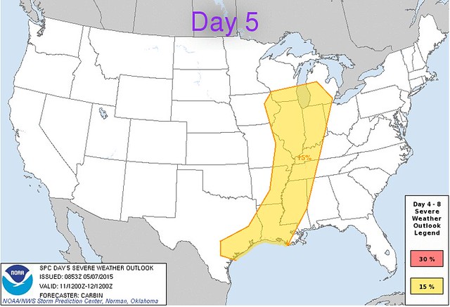
The nice thing about the Storm Prediction Center and it's technology is that they have been advising about Monday's possible severe weather since at least Thursday.
Excerpts from Sunday afternoon area forecast discussions, issued by the three regional National Weather Service offices that cover the Toledo region.
Cleveland - (Lucas, Wood, and Ottawa counties)
models have convection reaching nw oh about [4pm Mon]. forecast area remains in slight risk for severe thunderstorms monday afternoon/evening ahead of the front...just as weak low level jet moves into nw oh. main potential remains strong damaging winds and large hail.
Northern Indiana - (Fulton and Henry counties)
abundant cloud debris and possible precip in the 12-16z period tomorrow morning does not bode well for severe weather chances along actual cold frontal passage tomorrow afternoon.there is certainly some risk for severe weather but prefrontal clouds/precip and poor instability/lapse rates suggest a low risk at this point. if severe weather does occur... the greatest threat will be in our eastern cwa with damaging straight line winds the primary hazard.
CWA = County Warning Area
Detroit/Pontiac - (Monroe and Lenawee counties)
more likely scenario is that the day starts out fairly quiet within the warm sector...with highs reaching a muggy 70-80 degrees and southerly gusts picking up in the afternoon to around 20 mph.although instability will build during the day...and storms are possible at any time with smaller-scale triggers...the best potential for storms and a more organized threat for severe weather will be from 300 pm through 1000 pm as the cold front approaches and works across the area.
... instability does not look overly strong ...
30-40 kt low-level jet nosing into southeast michigan during the afternoon will also strengthen the wind field...increasing shear. taller/skinny cape and unidirectional wind profiles are more supportive of damaging winds and heavy rain than anything else.
but cannot rule out large hail or a small tornado as shear values do look high enough to support rotating updrafts. torrential downpours and localized flooding also possible with pw values in excess of 1.5 inches.
PW = Precipitable Water - measure of the depth of liquid water at the surface that would result after precipitating all of the water vapor in a vertical column over a given location, usually extending from the surface to 300 mb.
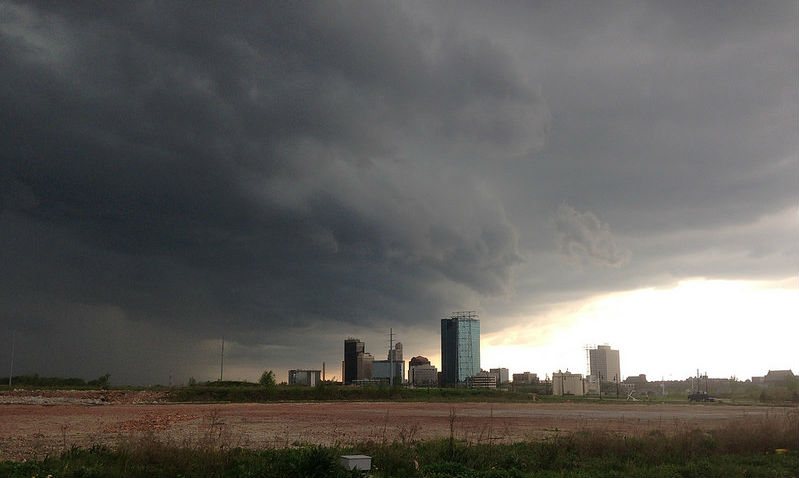
I don't think that Saturday afternoon's weather reached severe limits, but very heavy rain, some decent wind gusts, and pea-sized hail hit east Toledo. The storm moved south to north. We waited out the rain in the Marina District
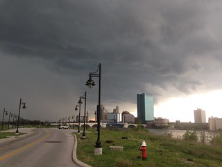
The heavy rain and hail nearly obscured the skyline.

From JR's : articles
436 words - 2813 chars
- 2 min read
created on
updated on
- #
source
- versions
Related articles
Severe weather threat for Sun, Nov 17, 2013 - Nov 18, 2013
Nov 17, 2013 Toledo area weather notes - Mar 03, 2014
Posts related to Nov 17, 2013 severe weather - Nov 21, 2013
Toledo area weather for early December 2013 - Dec 05, 2013
Mon, Dec 9, 2013 winter storm forecast for Sat, Dec 14 - Dec 14, 2013
more >>